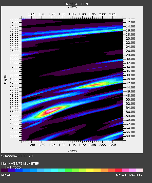
O21A Pagoda, CO, USA - Earthquake Result Viewer

Earthquake location: Andreanof Islands, Aleutian Is.
Earthquake latitude/longitude: 51.9/-179.2
Earthquake time(UTC): 2008/04/16 (107) 05:54:19 GMT
Earthquake Depth: 13 km
Earthquake Magnitude: 6.1 MB, 6.5 MS, 6.6 MW, 6.6 MW
Earthquake Catalog/Contributor: WHDF/NEIC
Network: TA USArray Transportable Network (new EarthScope stations)
Station: O21A Pagoda, CO, USA
Lat/Lon: 40.21 N/107.47 W
Elevation: 2343 m
Distance: 49.2 deg
Az: 73.892 deg
Baz: 308.946 deg
Ray Param: 0.06886091
Estimated Moho Depth: 54.75 km
Estimated Crust Vp/Vs: 1.75
Assumed Crust Vp: 6.159 km/s
Estimated Crust Vs: 3.514 km/s
Estimated Crust Poisson's Ratio: 0.26
Radial Match: 93.30079 %
Radial Bump: 400
Transverse Match: 79.748375 %
Transverse Bump: 400
SOD ConfigId: 2504
Insert Time: 2010-03-06 06:59:47.176 +0000
GWidth: 2.5
Max Bumps: 400
Tol: 0.001

Signal To Noise

ChannelStoNSTALTA
TA:O21A: :BHN:20080416T06:02:36.32501Z5.77356776.8782856E-71.19134064E-7
TA:O21A: :BHE:20080416T06:02:36.32501Z1.59260632.6573116E-71.6685301E-7
TA:O21A: :BHZ:20080416T06:02:36.32501Z3.44922763.299569E-79.566109E-8
Arrivals
Ps7.1 SECOND
PpPs23 SECOND
PsPs/PpSs30 SECOND