You are here: Home > Network List > CI - Caltech Regional Seismic Network Stations List
> Station BAR Barrett, Tecate, CA, USA > Earthquake Result Viewer
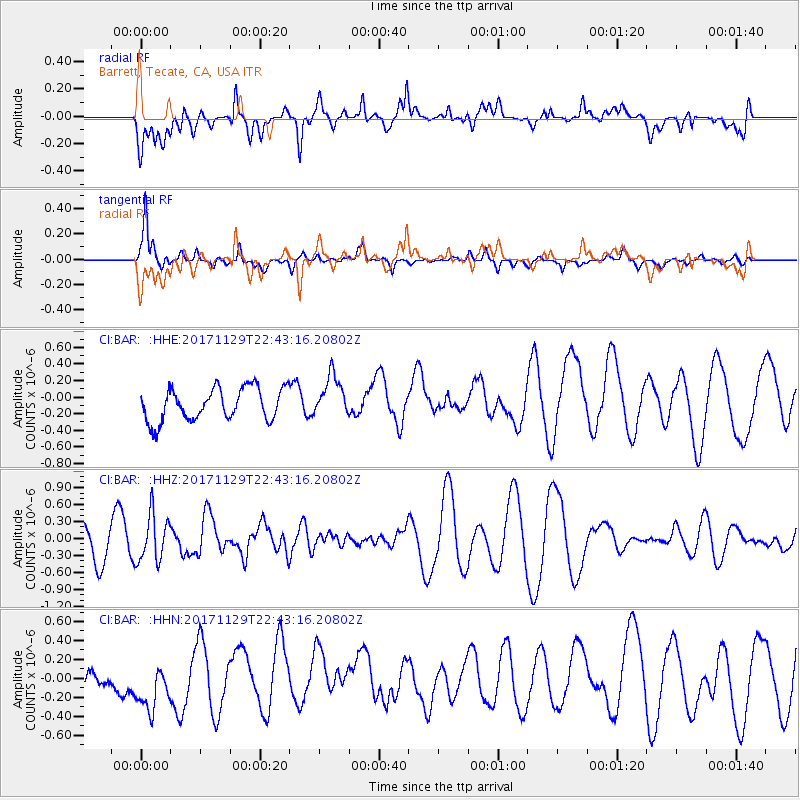
BAR Barrett, Tecate, CA, USA - Earthquake Result Viewer
*The percent match for this event was below the threshold and hence no stack was calculated.
| Earthquake location: |
Kuril Islands |
| Earthquake latitude/longitude: |
45.2/146.3 |
| Earthquake time(UTC): |
2017/11/29 (333) 22:32:23 GMT |
| Earthquake Depth: |
10 km |
| Earthquake Magnitude: |
5.4 Mww |
| Earthquake Catalog/Contributor: |
NEIC PDE/us |
|
| Network: |
CI Caltech Regional Seismic Network |
| Station: |
BAR Barrett, Tecate, CA, USA |
| Lat/Lon: |
32.68 N/116.67 W |
| Elevation: |
521 m |
|
| Distance: |
72.1 deg |
| Az: |
61.567 deg |
| Baz: |
312.493 deg |
| Ray Param: |
$rayparam |
*The percent match for this event was below the threshold and hence was not used in the summary stack. |
|
| Radial Match: |
64.57485 % |
| Radial Bump: |
400 |
| Transverse Match: |
60.746464 % |
| Transverse Bump: |
378 |
| SOD ConfigId: |
13570011 |
| Insert Time: |
2019-04-29 08:08:43.655 +0000 |
| GWidth: |
2.5 |
| Max Bumps: |
400 |
| Tol: |
0.001 |
|
Signal To Noise
| Channel | StoN | STA | LTA |
| CI:BAR: :HHZ:20171129T22:43:16.20802Z | 1.5638133 | 4.098217E-7 | 2.620656E-7 |
| CI:BAR: :HHN:20171129T22:43:16.20802Z | 1.5962193 | 3.703555E-7 | 2.3202045E-7 |
| CI:BAR: :HHE:20171129T22:43:16.20802Z | 1.2612195 | 2.490287E-7 | 1.9745072E-7 |
| Arrivals |
| Ps | |
| PpPs | |
| PsPs/PpSs | |


