You are here: Home > Network List > TA - USArray Transportable Network (new EarthScope stations) Stations List
> Station 121A Cookes Peak, Deming, NM, USA > Earthquake Result Viewer
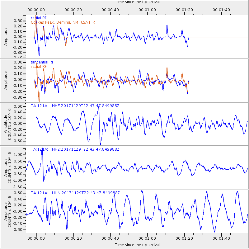
121A Cookes Peak, Deming, NM, USA - Earthquake Result Viewer
*The percent match for this event was below the threshold and hence no stack was calculated.
| Earthquake location: |
Kuril Islands |
| Earthquake latitude/longitude: |
45.2/146.3 |
| Earthquake time(UTC): |
2017/11/29 (333) 22:32:23 GMT |
| Earthquake Depth: |
10 km |
| Earthquake Magnitude: |
5.4 Mww |
| Earthquake Catalog/Contributor: |
NEIC PDE/us |
|
| Network: |
TA USArray Transportable Network (new EarthScope stations) |
| Station: |
121A Cookes Peak, Deming, NM, USA |
| Lat/Lon: |
32.53 N/107.79 W |
| Elevation: |
1652 m |
|
| Distance: |
77.6 deg |
| Az: |
56.264 deg |
| Baz: |
315.879 deg |
| Ray Param: |
$rayparam |
*The percent match for this event was below the threshold and hence was not used in the summary stack. |
|
| Radial Match: |
54.726055 % |
| Radial Bump: |
400 |
| Transverse Match: |
66.536354 % |
| Transverse Bump: |
400 |
| SOD ConfigId: |
13570011 |
| Insert Time: |
2019-04-29 08:13:38.949 +0000 |
| GWidth: |
2.5 |
| Max Bumps: |
400 |
| Tol: |
0.001 |
|
Signal To Noise
| Channel | StoN | STA | LTA |
| TA:121A: :HHZ:20171129T22:43:47.849988Z | 1.7852551 | 6.7391943E-7 | 3.7749194E-7 |
| TA:121A: :HHN:20171129T22:43:47.849988Z | 1.1800863 | 2.1430164E-7 | 1.8159828E-7 |
| TA:121A: :HHE:20171129T22:43:47.849988Z | 2.1064072 | 3.7717672E-7 | 1.7906164E-7 |
| Arrivals |
| Ps | |
| PpPs | |
| PsPs/PpSs | |


