You are here: Home > Network List > TA - USArray Transportable Network (new EarthScope stations) Stations List
> Station MSTX Muleshoe, TX, USA > Earthquake Result Viewer
MSTX Muleshoe, TX, USA - Earthquake Result Viewer
*The percent match for this event was below the threshold and hence no stack was calculated.
| Earthquake location: |
Kuril Islands |
| Earthquake latitude/longitude: |
45.2/146.3 |
| Earthquake time(UTC): |
2017/11/29 (333) 22:32:23 GMT |
| Earthquake Depth: |
10 km |
| Earthquake Magnitude: |
5.4 Mww |
| Earthquake Catalog/Contributor: |
NEIC PDE/us |
|
| Network: |
TA USArray Transportable Network (new EarthScope stations) |
| Station: |
MSTX Muleshoe, TX, USA |
| Lat/Lon: |
33.97 N/102.77 W |
| Elevation: |
1167 m |
|
| Distance: |
79.4 deg |
| Az: |
52.138 deg |
| Baz: |
317.796 deg |
| Ray Param: |
$rayparam |
*The percent match for this event was below the threshold and hence was not used in the summary stack. |
|
| Radial Match: |
61.387974 % |
| Radial Bump: |
400 |
| Transverse Match: |
52.608433 % |
| Transverse Bump: |
400 |
| SOD ConfigId: |
13570011 |
| Insert Time: |
2019-04-29 08:14:07.126 +0000 |
| GWidth: |
2.5 |
| Max Bumps: |
400 |
| Tol: |
0.001 |
|
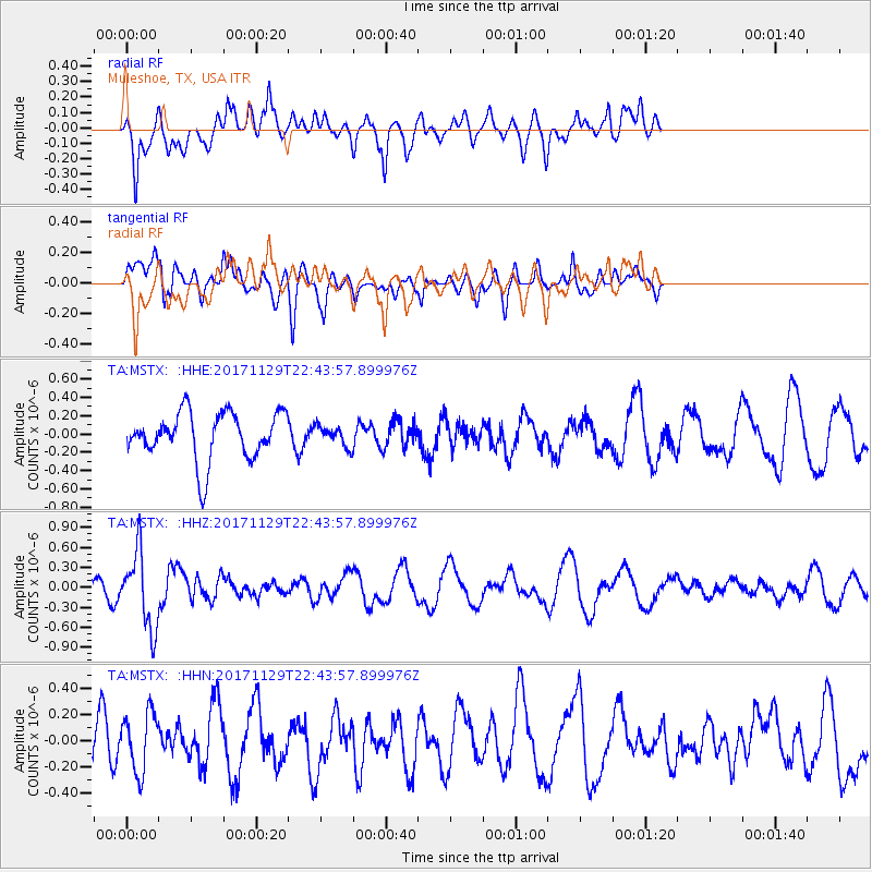
Signal To Noise
| Channel | StoN | STA | LTA |
| TA:MSTX: :HHZ:20171129T22:43:57.899976Z | 2.8925445 | 5.6697917E-7 | 1.9601399E-7 |
| TA:MSTX: :HHN:20171129T22:43:57.899976Z | 1.4990069 | 2.253208E-7 | 1.5031338E-7 |
| TA:MSTX: :HHE:20171129T22:43:57.899976Z | 0.43797895 | 1.139102E-7 | 2.6008144E-7 |
| Arrivals |
| Ps | |
| PpPs | |
| PsPs/PpSs | |


