You are here: Home > Network List > TA - USArray Transportable Network (new EarthScope stations) Stations List
> Station O21A Pagoda, CO, USA > Earthquake Result Viewer
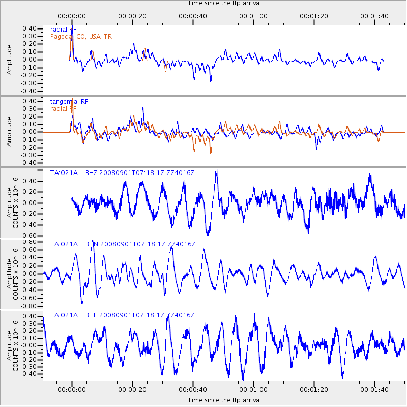
O21A Pagoda, CO, USA - Earthquake Result Viewer
*The percent match for this event was below the threshold and hence no stack was calculated.
| Earthquake location: |
Fiji Islands Region |
| Earthquake latitude/longitude: |
-15.3/-176.4 |
| Earthquake time(UTC): |
2008/09/01 (245) 07:06:16 GMT |
| Earthquake Depth: |
10 km |
| Earthquake Magnitude: |
5.6 MS, 5.4 MB, 5.7 MW, 5.7 MW |
| Earthquake Catalog/Contributor: |
WHDF/NEIC |
|
| Network: |
TA USArray Transportable Network (new EarthScope stations) |
| Station: |
O21A Pagoda, CO, USA |
| Lat/Lon: |
40.21 N/107.47 W |
| Elevation: |
2343 m |
|
| Distance: |
84.4 deg |
| Az: |
45.892 deg |
| Baz: |
244.827 deg |
| Ray Param: |
$rayparam |
*The percent match for this event was below the threshold and hence was not used in the summary stack. |
|
| Radial Match: |
53.09227 % |
| Radial Bump: |
400 |
| Transverse Match: |
56.976902 % |
| Transverse Bump: |
400 |
| SOD ConfigId: |
2504 |
| Insert Time: |
2010-03-06 07:01:29.429 +0000 |
| GWidth: |
2.5 |
| Max Bumps: |
400 |
| Tol: |
0.001 |
|
Signal To Noise
| Channel | StoN | STA | LTA |
| TA:O21A: :BHN:20080901T07:18:17.774016Z | 3.0480268 | 3.5772692E-7 | 1.1736344E-7 |
| TA:O21A: :BHE:20080901T07:18:17.774016Z | 0.5497909 | 1.0108418E-7 | 1.8385931E-7 |
| TA:O21A: :BHZ:20080901T07:18:17.774016Z | 1.5553014 | 2.4798072E-7 | 1.5944224E-7 |
| Arrivals |
| Ps | |
| PpPs | |
| PsPs/PpSs | |


