You are here: Home > Network List > TA - USArray Transportable Network (new EarthScope stations) Stations List
> Station O21A Pagoda, CO, USA > Earthquake Result Viewer
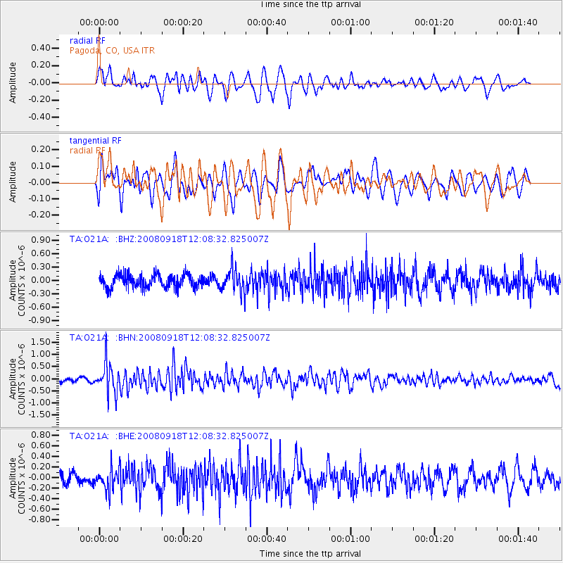
O21A Pagoda, CO, USA - Earthquake Result Viewer
*The percent match for this event was below the threshold and hence no stack was calculated.
| Earthquake location: |
Near East Coast Of Kamchatka |
| Earthquake latitude/longitude: |
51.9/158.4 |
| Earthquake time(UTC): |
2008/09/18 (262) 11:58:50 GMT |
| Earthquake Depth: |
67 km |
| Earthquake Magnitude: |
5.7 MB, 5.9 MW, 5.8 MW |
| Earthquake Catalog/Contributor: |
WHDF/NEIC |
|
| Network: |
TA USArray Transportable Network (new EarthScope stations) |
| Station: |
O21A Pagoda, CO, USA |
| Lat/Lon: |
40.21 N/107.47 W |
| Elevation: |
2343 m |
|
| Distance: |
61.9 deg |
| Az: |
59.956 deg |
| Baz: |
315.565 deg |
| Ray Param: |
$rayparam |
*The percent match for this event was below the threshold and hence was not used in the summary stack. |
|
| Radial Match: |
71.89231 % |
| Radial Bump: |
400 |
| Transverse Match: |
51.67023 % |
| Transverse Bump: |
400 |
| SOD ConfigId: |
2560 |
| Insert Time: |
2010-03-06 07:01:34.014 +0000 |
| GWidth: |
2.5 |
| Max Bumps: |
400 |
| Tol: |
0.001 |
|
Signal To Noise
| Channel | StoN | STA | LTA |
| TA:O21A: :BHN:20080918T12:08:32.825007Z | 6.912289 | 6.423592E-7 | 9.293003E-8 |
| TA:O21A: :BHE:20080918T12:08:32.825007Z | 1.9616365 | 2.0172382E-7 | 1.0283445E-7 |
| TA:O21A: :BHZ:20080918T12:08:32.825007Z | 1.8976494 | 2.6880699E-7 | 1.4165262E-7 |
| Arrivals |
| Ps | |
| PpPs | |
| PsPs/PpSs | |


