You are here: Home > Network List > TA - USArray Transportable Network (new EarthScope stations) Stations List
> Station O21A Pagoda, CO, USA > Earthquake Result Viewer
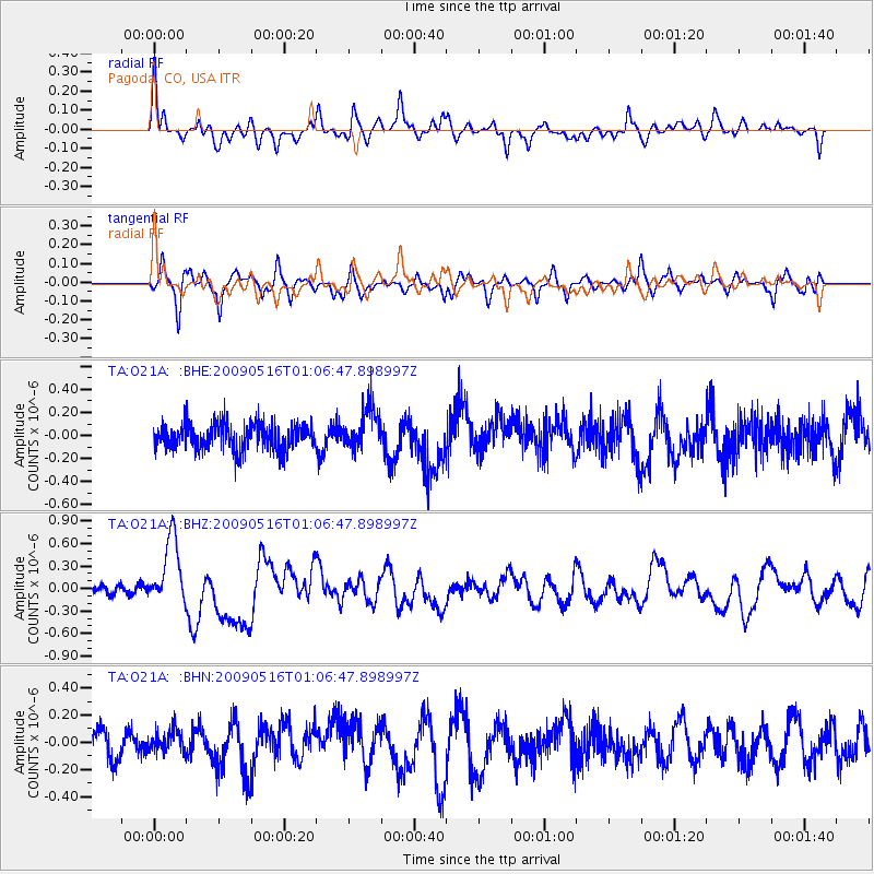
O21A Pagoda, CO, USA - Earthquake Result Viewer
*The percent match for this event was below the threshold and hence no stack was calculated.
| Earthquake location: |
Kermadec Islands Region |
| Earthquake latitude/longitude: |
-31.5/-178.8 |
| Earthquake time(UTC): |
2009/05/16 (136) 00:53:52 GMT |
| Earthquake Depth: |
55 km |
| Earthquake Magnitude: |
6.1 MB, 6.5 MW, 6.3 MW |
| Earthquake Catalog/Contributor: |
WHDF/NEIC |
|
| Network: |
TA USArray Transportable Network (new EarthScope stations) |
| Station: |
O21A Pagoda, CO, USA |
| Lat/Lon: |
40.21 N/107.47 W |
| Elevation: |
2343 m |
|
| Distance: |
97.2 deg |
| Az: |
46.985 deg |
| Baz: |
234.632 deg |
| Ray Param: |
$rayparam |
*The percent match for this event was below the threshold and hence was not used in the summary stack. |
|
| Radial Match: |
67.13522 % |
| Radial Bump: |
400 |
| Transverse Match: |
68.02573 % |
| Transverse Bump: |
400 |
| SOD ConfigId: |
2760 |
| Insert Time: |
2010-03-06 07:01:37.166 +0000 |
| GWidth: |
2.5 |
| Max Bumps: |
400 |
| Tol: |
0.001 |
|
Signal To Noise
| Channel | StoN | STA | LTA |
| TA:O21A: :BHZ:20090516T01:06:47.898997Z | 6.386815 | 4.5755718E-7 | 7.16409E-8 |
| TA:O21A: :BHN:20090516T01:06:47.898997Z | 0.816496 | 8.625738E-8 | 1.0564335E-7 |
| TA:O21A: :BHE:20090516T01:06:47.898997Z | 1.6160668 | 1.794956E-7 | 1.1106941E-7 |
| Arrivals |
| Ps | |
| PpPs | |
| PsPs/PpSs | |


