You are here: Home > Network List > TA - USArray Transportable Network (new EarthScope stations) Stations List
> Station O21A Pagoda, CO, USA > Earthquake Result Viewer
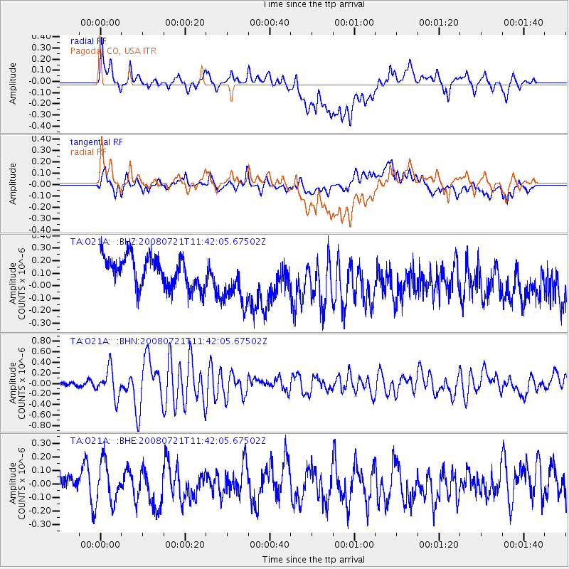
O21A Pagoda, CO, USA - Earthquake Result Viewer
*The percent match for this event was below the threshold and hence no stack was calculated.
| Earthquake location: |
Off East Coast Of Honshu, Japan |
| Earthquake latitude/longitude: |
37.2/142.1 |
| Earthquake time(UTC): |
2008/07/21 (203) 11:30:29 GMT |
| Earthquake Depth: |
22 km |
| Earthquake Magnitude: |
5.7 MB, 5.6 MS, 6.0 MW, 5.9 MW |
| Earthquake Catalog/Contributor: |
WHDF/NEIC |
|
| Network: |
TA USArray Transportable Network (new EarthScope stations) |
| Station: |
O21A Pagoda, CO, USA |
| Lat/Lon: |
40.21 N/107.47 W |
| Elevation: |
2343 m |
|
| Distance: |
80.0 deg |
| Az: |
46.749 deg |
| Baz: |
310.569 deg |
| Ray Param: |
$rayparam |
*The percent match for this event was below the threshold and hence was not used in the summary stack. |
|
| Radial Match: |
61.597473 % |
| Radial Bump: |
400 |
| Transverse Match: |
50.967422 % |
| Transverse Bump: |
400 |
| SOD ConfigId: |
2504 |
| Insert Time: |
2010-03-06 07:02:08.142 +0000 |
| GWidth: |
2.5 |
| Max Bumps: |
400 |
| Tol: |
0.001 |
|
Signal To Noise
| Channel | StoN | STA | LTA |
| TA:O21A: :BHN:20080721T11:42:05.67502Z | 6.315055 | 2.784191E-7 | 4.408815E-8 |
| TA:O21A: :BHE:20080721T11:42:05.67502Z | 0.8412589 | 1.635137E-7 | 1.9436787E-7 |
| TA:O21A: :BHZ:20080721T11:42:05.67502Z | 1.7096238 | 2.0521388E-7 | 1.2003453E-7 |
| Arrivals |
| Ps | |
| PpPs | |
| PsPs/PpSs | |


