You are here: Home > Network List > TA - USArray Transportable Network (new EarthScope stations) Stations List
> Station O21A Pagoda, CO, USA > Earthquake Result Viewer
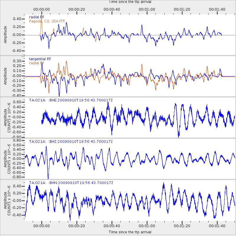
O21A Pagoda, CO, USA - Earthquake Result Viewer
*The percent match for this event was below the threshold and hence no stack was calculated.
| Earthquake location: |
Easter Island Region |
| Earthquake latitude/longitude: |
-29.9/-111.8 |
| Earthquake time(UTC): |
2009/09/10 (253) 19:46:03 GMT |
| Earthquake Depth: |
10 km |
| Earthquake Magnitude: |
5.5 MW, 5.4 MB |
| Earthquake Catalog/Contributor: |
WHDF/NEIC |
|
| Network: |
TA USArray Transportable Network (new EarthScope stations) |
| Station: |
O21A Pagoda, CO, USA |
| Lat/Lon: |
40.21 N/107.47 W |
| Elevation: |
2343 m |
|
| Distance: |
69.9 deg |
| Az: |
3.549 deg |
| Baz: |
184.024 deg |
| Ray Param: |
$rayparam |
*The percent match for this event was below the threshold and hence was not used in the summary stack. |
|
| Radial Match: |
46.159866 % |
| Radial Bump: |
400 |
| Transverse Match: |
38.662334 % |
| Transverse Bump: |
400 |
| SOD ConfigId: |
2622 |
| Insert Time: |
2010-03-06 07:02:36.492 +0000 |
| GWidth: |
2.5 |
| Max Bumps: |
400 |
| Tol: |
0.001 |
|
Signal To Noise
| Channel | StoN | STA | LTA |
| TA:O21A: :BHZ:20090910T19:56:43.700017Z | 2.8813105 | 3.5019406E-7 | 1.2153986E-7 |
| TA:O21A: :BHN:20090910T19:56:43.700017Z | 0.8939209 | 1.8184241E-7 | 2.0342114E-7 |
| TA:O21A: :BHE:20090910T19:56:43.700017Z | 1.3047041 | 2.0123933E-7 | 1.5424135E-7 |
| Arrivals |
| Ps | |
| PpPs | |
| PsPs/PpSs | |


