You are here: Home > Network List > TA - USArray Transportable Network (new EarthScope stations) Stations List
> Station O21A Pagoda, CO, USA > Earthquake Result Viewer
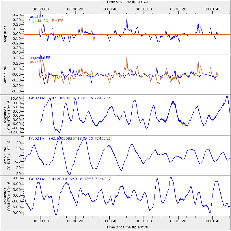
O21A Pagoda, CO, USA - Earthquake Result Viewer
*The percent match for this event was below the threshold and hence no stack was calculated.
| Earthquake location: |
Tonga Islands |
| Earthquake latitude/longitude: |
-15.4/-173.2 |
| Earthquake time(UTC): |
2009/09/29 (272) 17:56:05 GMT |
| Earthquake Depth: |
10 km |
| Earthquake Magnitude: |
6.0 MB |
| Earthquake Catalog/Contributor: |
WHDF/NEIC |
|
| Network: |
TA USArray Transportable Network (new EarthScope stations) |
| Station: |
O21A Pagoda, CO, USA |
| Lat/Lon: |
40.21 N/107.47 W |
| Elevation: |
2343 m |
|
| Distance: |
82.2 deg |
| Az: |
44.772 deg |
| Baz: |
242.538 deg |
| Ray Param: |
$rayparam |
*The percent match for this event was below the threshold and hence was not used in the summary stack. |
|
| Radial Match: |
56.80688 % |
| Radial Bump: |
400 |
| Transverse Match: |
64.52769 % |
| Transverse Bump: |
400 |
| SOD ConfigId: |
2622 |
| Insert Time: |
2010-03-06 07:02:37.668 +0000 |
| GWidth: |
2.5 |
| Max Bumps: |
400 |
| Tol: |
0.001 |
|
Signal To Noise
| Channel | StoN | STA | LTA |
| TA:O21A: :BHZ:20090929T18:07:55.724021Z | 1.9615549 | 1.1930808E-5 | 6.0823213E-6 |
| TA:O21A: :BHN:20090929T18:07:55.724021Z | 0.78701687 | 2.7995102E-6 | 3.5571156E-6 |
| TA:O21A: :BHE:20090929T18:07:55.724021Z | 0.7989836 | 5.7976554E-6 | 7.256289E-6 |
| Arrivals |
| Ps | |
| PpPs | |
| PsPs/PpSs | |


