You are here: Home > Network List > CN - Canadian National Seismograph Network Stations List
> Station INK INUVIK, NT > Earthquake Result Viewer
INK INUVIK, NT - Earthquake Result Viewer
*The percent match for this event was below the threshold and hence no stack was calculated.
| Earthquake location: |
Central Mid-Atlantic Ridge |
| Earthquake latitude/longitude: |
-1.1/-23.5 |
| Earthquake time(UTC): |
2017/11/30 (334) 06:32:52 GMT |
| Earthquake Depth: |
10 km |
| Earthquake Magnitude: |
6.5 Mi |
| Earthquake Catalog/Contributor: |
NEIC PDE/at |
|
| Network: |
CN Canadian National Seismograph Network |
| Station: |
INK INUVIK, NT |
| Lat/Lon: |
68.31 N/133.53 W |
| Elevation: |
44 m |
|
| Distance: |
98.3 deg |
| Az: |
339.327 deg |
| Baz: |
71.696 deg |
| Ray Param: |
$rayparam |
*The percent match for this event was below the threshold and hence was not used in the summary stack. |
|
| Radial Match: |
46.533382 % |
| Radial Bump: |
400 |
| Transverse Match: |
66.1713 % |
| Transverse Bump: |
400 |
| SOD ConfigId: |
13570011 |
| Insert Time: |
2019-04-29 08:25:12.426 +0000 |
| GWidth: |
2.5 |
| Max Bumps: |
400 |
| Tol: |
0.001 |
|
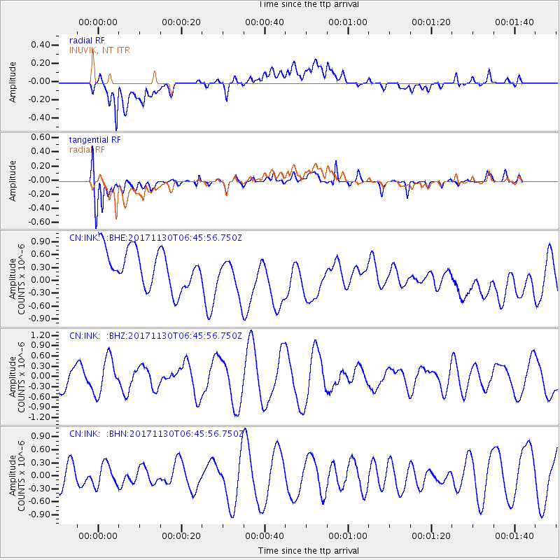
Signal To Noise
| Channel | StoN | STA | LTA |
| CN:INK: :BHZ:20171130T06:45:56.750Z | 1.2605522 | 5.314827E-7 | 4.2162694E-7 |
| CN:INK: :BHN:20171130T06:45:56.750Z | 1.0796633 | 2.6300282E-7 | 2.435971E-7 |
| CN:INK: :BHE:20171130T06:45:56.750Z | 1.4941298 | 6.5228835E-7 | 4.3656738E-7 |
| Arrivals |
| Ps | |
| PpPs | |
| PsPs/PpSs | |


