You are here: Home > Network List > GS - US Geological Survey Networks Stations List
> Station OK051 E0350 and S34600 Roads, Ralston, OK > Earthquake Result Viewer
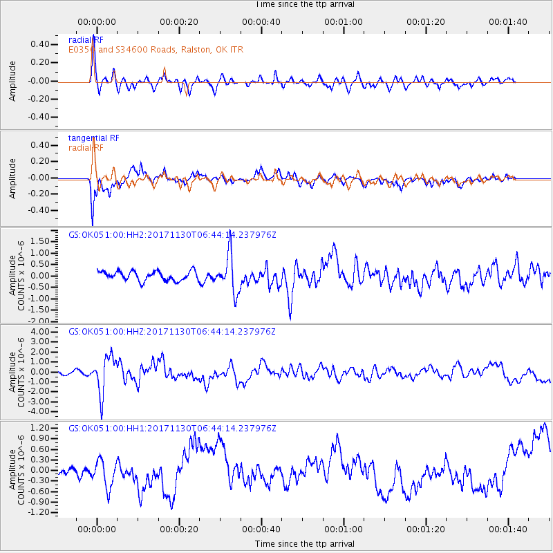
OK051 E0350 and S34600 Roads, Ralston, OK - Earthquake Result Viewer
*The percent match for this event was below the threshold and hence no stack was calculated.
| Earthquake location: |
Central Mid-Atlantic Ridge |
| Earthquake latitude/longitude: |
-1.1/-23.5 |
| Earthquake time(UTC): |
2017/11/30 (334) 06:32:52 GMT |
| Earthquake Depth: |
10 km |
| Earthquake Magnitude: |
6.5 Mi |
| Earthquake Catalog/Contributor: |
NEIC PDE/at |
|
| Network: |
GS US Geological Survey Networks |
| Station: |
OK051 E0350 and S34600 Roads, Ralston, OK |
| Lat/Lon: |
36.51 N/96.84 W |
| Elevation: |
263 m |
|
| Distance: |
77.3 deg |
| Az: |
307.702 deg |
| Baz: |
100.942 deg |
| Ray Param: |
$rayparam |
*The percent match for this event was below the threshold and hence was not used in the summary stack. |
|
| Radial Match: |
75.140236 % |
| Radial Bump: |
343 |
| Transverse Match: |
73.815315 % |
| Transverse Bump: |
375 |
| SOD ConfigId: |
13570011 |
| Insert Time: |
2019-04-29 08:26:28.484 +0000 |
| GWidth: |
2.5 |
| Max Bumps: |
400 |
| Tol: |
0.001 |
|
Signal To Noise
| Channel | StoN | STA | LTA |
| GS:OK051:00:HHZ:20171130T06:44:14.237976Z | 7.632761 | 1.9173583E-6 | 2.5120116E-7 |
| GS:OK051:00:HH1:20171130T06:44:14.237976Z | 1.3943415 | 4.474887E-7 | 3.2093195E-7 |
| GS:OK051:00:HH2:20171130T06:44:14.237976Z | 4.0116377 | 8.683381E-7 | 2.1645478E-7 |
| Arrivals |
| Ps | |
| PpPs | |
| PsPs/PpSs | |


