You are here: Home > Network List > TA - USArray Transportable Network (new EarthScope stations) Stations List
> Station 435B Jarrell, TX, USA > Earthquake Result Viewer
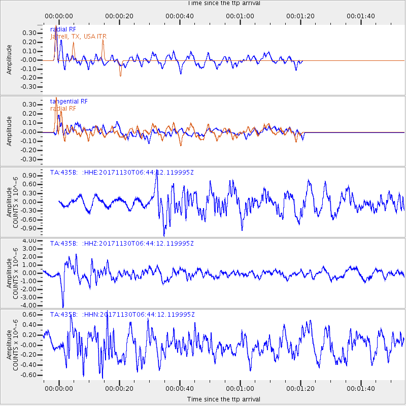
435B Jarrell, TX, USA - Earthquake Result Viewer
*The percent match for this event was below the threshold and hence no stack was calculated.
| Earthquake location: |
Central Mid-Atlantic Ridge |
| Earthquake latitude/longitude: |
-1.1/-23.5 |
| Earthquake time(UTC): |
2017/11/30 (334) 06:32:52 GMT |
| Earthquake Depth: |
10 km |
| Earthquake Magnitude: |
6.5 Mi |
| Earthquake Catalog/Contributor: |
NEIC PDE/at |
|
| Network: |
TA USArray Transportable Network (new EarthScope stations) |
| Station: |
435B Jarrell, TX, USA |
| Lat/Lon: |
30.78 N/97.58 W |
| Elevation: |
248 m |
|
| Distance: |
76.9 deg |
| Az: |
301.825 deg |
| Baz: |
99.217 deg |
| Ray Param: |
$rayparam |
*The percent match for this event was below the threshold and hence was not used in the summary stack. |
|
| Radial Match: |
70.73472 % |
| Radial Bump: |
400 |
| Transverse Match: |
58.487785 % |
| Transverse Bump: |
400 |
| SOD ConfigId: |
13570011 |
| Insert Time: |
2019-04-29 08:32:07.922 +0000 |
| GWidth: |
2.5 |
| Max Bumps: |
400 |
| Tol: |
0.001 |
|
Signal To Noise
| Channel | StoN | STA | LTA |
| TA:435B: :HHZ:20171130T06:44:12.119995Z | 10.311721 | 1.5436677E-6 | 1.4970031E-7 |
| TA:435B: :HHN:20171130T06:44:12.119995Z | 1.6374727 | 2.562086E-7 | 1.5646587E-7 |
| TA:435B: :HHE:20171130T06:44:12.119995Z | 3.8152485 | 5.744518E-7 | 1.5056735E-7 |
| Arrivals |
| Ps | |
| PpPs | |
| PsPs/PpSs | |


