You are here: Home > Network List > TA - USArray Transportable Network (new EarthScope stations) Stations List
> Station BGNE Belgrade, NE, USA > Earthquake Result Viewer
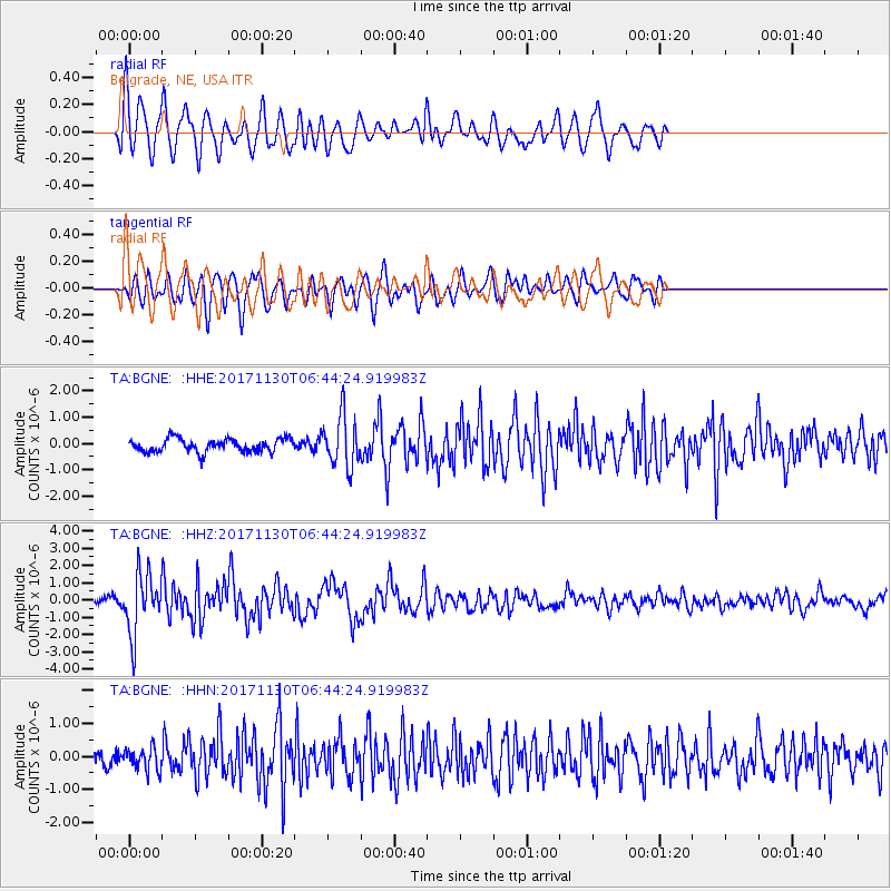
BGNE Belgrade, NE, USA - Earthquake Result Viewer
*The percent match for this event was below the threshold and hence no stack was calculated.
| Earthquake location: |
Central Mid-Atlantic Ridge |
| Earthquake latitude/longitude: |
-1.1/-23.5 |
| Earthquake time(UTC): |
2017/11/30 (334) 06:32:52 GMT |
| Earthquake Depth: |
10 km |
| Earthquake Magnitude: |
6.5 Mi |
| Earthquake Catalog/Contributor: |
NEIC PDE/at |
|
| Network: |
TA USArray Transportable Network (new EarthScope stations) |
| Station: |
BGNE Belgrade, NE, USA |
| Lat/Lon: |
41.41 N/98.15 W |
| Elevation: |
573 m |
|
| Distance: |
79.3 deg |
| Az: |
312.41 deg |
| Baz: |
101.076 deg |
| Ray Param: |
$rayparam |
*The percent match for this event was below the threshold and hence was not used in the summary stack. |
|
| Radial Match: |
77.68259 % |
| Radial Bump: |
400 |
| Transverse Match: |
68.2431 % |
| Transverse Bump: |
400 |
| SOD ConfigId: |
13570011 |
| Insert Time: |
2019-04-29 08:32:13.710 +0000 |
| GWidth: |
2.5 |
| Max Bumps: |
400 |
| Tol: |
0.001 |
|
Signal To Noise
| Channel | StoN | STA | LTA |
| TA:BGNE: :HHZ:20171130T06:44:24.919983Z | 9.139041 | 1.75586E-6 | 1.921274E-7 |
| TA:BGNE: :HHN:20171130T06:44:24.919983Z | 1.0947658 | 3.3529057E-7 | 3.0626694E-7 |
| TA:BGNE: :HHE:20171130T06:44:24.919983Z | 3.855588 | 9.722421E-7 | 2.5216443E-7 |
| Arrivals |
| Ps | |
| PpPs | |
| PsPs/PpSs | |


