You are here: Home > Network List > TA - USArray Transportable Network (new EarthScope stations) Stations List
> Station KSCO Kaye Shedlock's, Cheyenne Wells, CO, USA > Earthquake Result Viewer
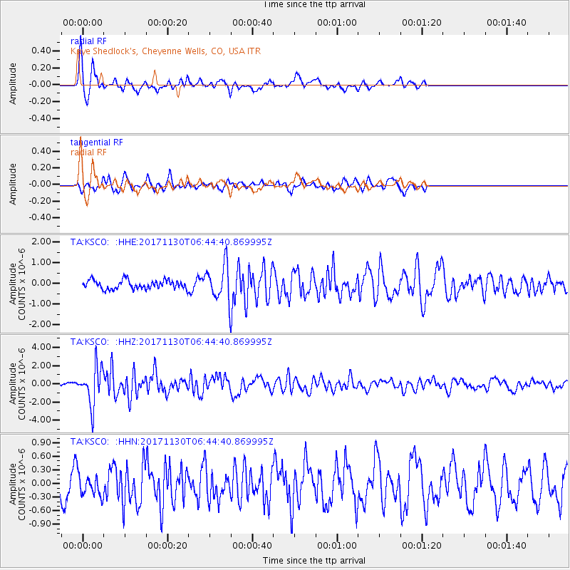
KSCO Kaye Shedlock's, Cheyenne Wells, CO, USA - Earthquake Result Viewer
*The percent match for this event was below the threshold and hence no stack was calculated.
| Earthquake location: |
Central Mid-Atlantic Ridge |
| Earthquake latitude/longitude: |
-1.1/-23.5 |
| Earthquake time(UTC): |
2017/11/30 (334) 06:32:52 GMT |
| Earthquake Depth: |
10 km |
| Earthquake Magnitude: |
6.5 Mi |
| Earthquake Catalog/Contributor: |
NEIC PDE/at |
|
| Network: |
TA USArray Transportable Network (new EarthScope stations) |
| Station: |
KSCO Kaye Shedlock's, Cheyenne Wells, CO, USA |
| Lat/Lon: |
39.01 N/102.63 W |
| Elevation: |
1382 m |
|
| Distance: |
82.2 deg |
| Az: |
309.451 deg |
| Baz: |
97.719 deg |
| Ray Param: |
$rayparam |
*The percent match for this event was below the threshold and hence was not used in the summary stack. |
|
| Radial Match: |
79.50359 % |
| Radial Bump: |
382 |
| Transverse Match: |
59.273254 % |
| Transverse Bump: |
322 |
| SOD ConfigId: |
13570011 |
| Insert Time: |
2019-04-29 08:32:14.892 +0000 |
| GWidth: |
2.5 |
| Max Bumps: |
400 |
| Tol: |
0.001 |
|
Signal To Noise
| Channel | StoN | STA | LTA |
| TA:KSCO: :HHZ:20171130T06:44:40.869995Z | 9.651744 | 2.140659E-6 | 2.2178988E-7 |
| TA:KSCO: :HHN:20171130T06:44:40.869995Z | 1.11214 | 2.1813804E-7 | 1.961426E-7 |
| TA:KSCO: :HHE:20171130T06:44:40.869995Z | 4.536281 | 1.0358617E-6 | 2.2835043E-7 |
| Arrivals |
| Ps | |
| PpPs | |
| PsPs/PpSs | |


