You are here: Home > Network List > US - United States National Seismic Network Stations List
> Station CBKS Cedar Bluff, Kansas, USA > Earthquake Result Viewer
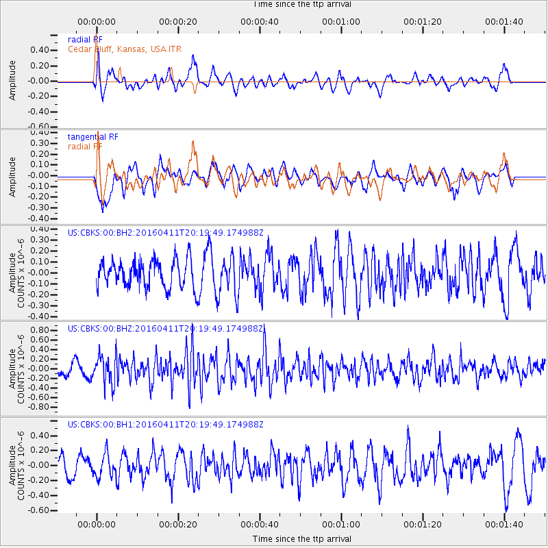
CBKS Cedar Bluff, Kansas, USA - Earthquake Result Viewer
*The percent match for this event was below the threshold and hence no stack was calculated.
| Earthquake location: |
Rat Islands, Aleutian Islands |
| Earthquake latitude/longitude: |
51.8/176.6 |
| Earthquake time(UTC): |
2016/04/11 (102) 20:10:35 GMT |
| Earthquake Depth: |
22 km |
| Earthquake Magnitude: |
5.6 MB, 5.5 MB, 5.6 MI |
| Earthquake Catalog/Contributor: |
NEIC PDE/NEIC COMCAT |
|
| Network: |
US United States National Seismic Network |
| Station: |
CBKS Cedar Bluff, Kansas, USA |
| Lat/Lon: |
38.81 N/99.74 W |
| Elevation: |
677 m |
|
| Distance: |
57.1 deg |
| Az: |
67.64 deg |
| Baz: |
312.744 deg |
| Ray Param: |
$rayparam |
*The percent match for this event was below the threshold and hence was not used in the summary stack. |
|
| Radial Match: |
59.541107 % |
| Radial Bump: |
400 |
| Transverse Match: |
65.02722 % |
| Transverse Bump: |
400 |
| SOD ConfigId: |
1475611 |
| Insert Time: |
2016-04-25 20:26:21.547 +0000 |
| GWidth: |
2.5 |
| Max Bumps: |
400 |
| Tol: |
0.001 |
|
Signal To Noise
| Channel | StoN | STA | LTA |
| US:CBKS:00:BHZ:20160411T20:19:49.174988Z | 3.1765795 | 3.0041133E-7 | 9.4570694E-8 |
| US:CBKS:00:BH1:20160411T20:19:49.174988Z | 1.2301539 | 1.578923E-7 | 1.2835167E-7 |
| US:CBKS:00:BH2:20160411T20:19:49.174988Z | 1.5158316 | 1.8513605E-7 | 1.2213498E-7 |
| Arrivals |
| Ps | |
| PpPs | |
| PsPs/PpSs | |


