You are here: Home > Network List > TA - USArray Transportable Network (new EarthScope stations) Stations List
> Station A22K Sinclair Lake, AK, USA > Earthquake Result Viewer
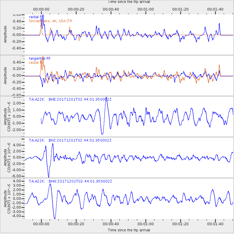
A22K Sinclair Lake, AK, USA - Earthquake Result Viewer
*The percent match for this event was below the threshold and hence no stack was calculated.
| Earthquake location: |
Northern And Central Iran |
| Earthquake latitude/longitude: |
30.7/57.3 |
| Earthquake time(UTC): |
2017/12/01 (335) 02:32:46 GMT |
| Earthquake Depth: |
9.0 km |
| Earthquake Magnitude: |
6.1 Mww |
| Earthquake Catalog/Contributor: |
NEIC PDE/us |
|
| Network: |
TA USArray Transportable Network (new EarthScope stations) |
| Station: |
A22K Sinclair Lake, AK, USA |
| Lat/Lon: |
71.00 N/154.97 W |
| Elevation: |
6.0 m |
|
| Distance: |
76.0 deg |
| Az: |
10.387 deg |
| Baz: |
331.704 deg |
| Ray Param: |
$rayparam |
*The percent match for this event was below the threshold and hence was not used in the summary stack. |
|
| Radial Match: |
62.152004 % |
| Radial Bump: |
388 |
| Transverse Match: |
70.94887 % |
| Transverse Bump: |
400 |
| SOD ConfigId: |
13570011 |
| Insert Time: |
2019-04-29 08:39:34.071 +0000 |
| GWidth: |
2.5 |
| Max Bumps: |
400 |
| Tol: |
0.001 |
|
Signal To Noise
| Channel | StoN | STA | LTA |
| TA:A22K: :BHZ:20171201T02:44:01.950002Z | 8.239848 | 2.8293991E-6 | 3.4338E-7 |
| TA:A22K: :BHN:20171201T02:44:01.950002Z | 2.1004174 | 1.2282931E-6 | 5.8478525E-7 |
| TA:A22K: :BHE:20171201T02:44:01.950002Z | 1.9882336 | 1.0266665E-6 | 5.163712E-7 |
| Arrivals |
| Ps | |
| PpPs | |
| PsPs/PpSs | |


