You are here: Home > Network List > TA - USArray Transportable Network (new EarthScope stations) Stations List
> Station M11K Mekoryuk, AK, USA > Earthquake Result Viewer
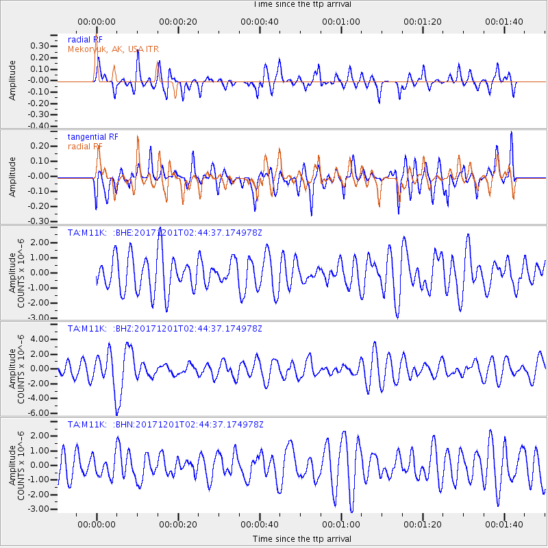
M11K Mekoryuk, AK, USA - Earthquake Result Viewer
*The percent match for this event was below the threshold and hence no stack was calculated.
| Earthquake location: |
Northern And Central Iran |
| Earthquake latitude/longitude: |
30.7/57.3 |
| Earthquake time(UTC): |
2017/12/01 (335) 02:32:46 GMT |
| Earthquake Depth: |
9.0 km |
| Earthquake Magnitude: |
6.1 Mww |
| Earthquake Catalog/Contributor: |
NEIC PDE/us |
|
| Network: |
TA USArray Transportable Network (new EarthScope stations) |
| Station: |
M11K Mekoryuk, AK, USA |
| Lat/Lon: |
60.38 N/166.20 W |
| Elevation: |
3.0 m |
|
| Distance: |
82.5 deg |
| Az: |
20.18 deg |
| Baz: |
323.273 deg |
| Ray Param: |
$rayparam |
*The percent match for this event was below the threshold and hence was not used in the summary stack. |
|
| Radial Match: |
49.586555 % |
| Radial Bump: |
356 |
| Transverse Match: |
50.104877 % |
| Transverse Bump: |
400 |
| SOD ConfigId: |
13570011 |
| Insert Time: |
2019-04-29 08:41:00.306 +0000 |
| GWidth: |
2.5 |
| Max Bumps: |
400 |
| Tol: |
0.001 |
|
Signal To Noise
| Channel | StoN | STA | LTA |
| TA:M11K: :BHZ:20171201T02:44:37.174978Z | 2.8277311 | 2.213466E-6 | 7.82771E-7 |
| TA:M11K: :BHN:20171201T02:44:37.174978Z | 0.4718713 | 6.918737E-7 | 1.4662339E-6 |
| TA:M11K: :BHE:20171201T02:44:37.174978Z | 0.56122386 | 6.720558E-7 | 1.1974827E-6 |
| Arrivals |
| Ps | |
| PpPs | |
| PsPs/PpSs | |


