You are here: Home > Network List > AV - Alaska Volcano Observatory Stations List
> Station AMKA Regional Station, Amchitka Island, Alaska > Earthquake Result Viewer
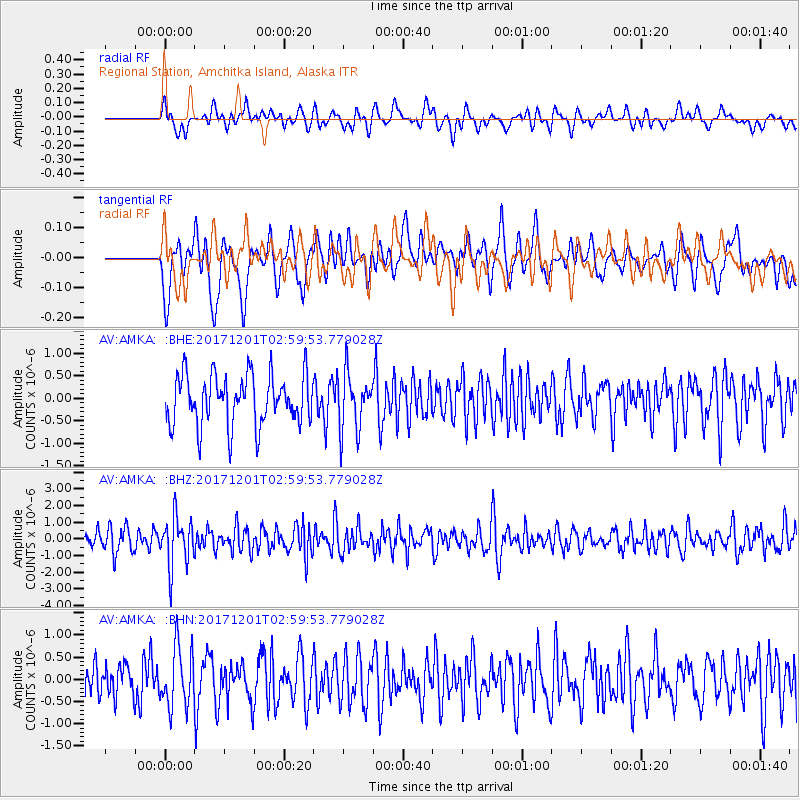
AMKA Regional Station, Amchitka Island, Alaska - Earthquake Result Viewer
*The percent match for this event was below the threshold and hence no stack was calculated.
| Earthquake location: |
Eastern New Guinea Reg., P.N.G. |
| Earthquake latitude/longitude: |
-6.1/147.6 |
| Earthquake time(UTC): |
2017/12/01 (335) 02:49:59 GMT |
| Earthquake Depth: |
40 km |
| Earthquake Magnitude: |
6.0 Mww |
| Earthquake Catalog/Contributor: |
NEIC PDE/us |
|
| Network: |
AV Alaska Volcano Observatory |
| Station: |
AMKA Regional Station, Amchitka Island, Alaska |
| Lat/Lon: |
51.38 N/179.30 E |
| Elevation: |
116 m |
|
| Distance: |
63.4 deg |
| Az: |
21.597 deg |
| Baz: |
215.732 deg |
| Ray Param: |
$rayparam |
*The percent match for this event was below the threshold and hence was not used in the summary stack. |
|
| Radial Match: |
51.649715 % |
| Radial Bump: |
400 |
| Transverse Match: |
55.65218 % |
| Transverse Bump: |
400 |
| SOD ConfigId: |
13570011 |
| Insert Time: |
2019-04-29 08:42:54.109 +0000 |
| GWidth: |
2.5 |
| Max Bumps: |
400 |
| Tol: |
0.001 |
|
Signal To Noise
| Channel | StoN | STA | LTA |
| AV:AMKA: :BHZ:20171201T02:59:53.779028Z | 2.5337772 | 1.4933779E-6 | 5.89388E-7 |
| AV:AMKA: :BHN:20171201T02:59:53.779028Z | 1.7528135 | 6.819262E-7 | 3.8904668E-7 |
| AV:AMKA: :BHE:20171201T02:59:53.779028Z | 1.1474961 | 6.4032173E-7 | 5.580165E-7 |
| Arrivals |
| Ps | |
| PpPs | |
| PsPs/PpSs | |


