You are here: Home > Network List > CN - Canadian National Seismograph Network Stations List
> Station INK INUVIK, NT > Earthquake Result Viewer
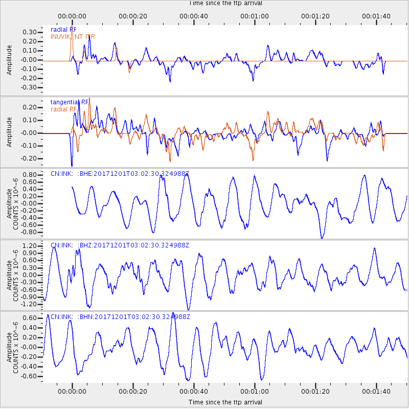
INK INUVIK, NT - Earthquake Result Viewer
*The percent match for this event was below the threshold and hence no stack was calculated.
| Earthquake location: |
Eastern New Guinea Reg., P.N.G. |
| Earthquake latitude/longitude: |
-6.1/147.6 |
| Earthquake time(UTC): |
2017/12/01 (335) 02:49:59 GMT |
| Earthquake Depth: |
40 km |
| Earthquake Magnitude: |
6.0 Mww |
| Earthquake Catalog/Contributor: |
NEIC PDE/us |
|
| Network: |
CN Canadian National Seismograph Network |
| Station: |
INK INUVIK, NT |
| Lat/Lon: |
68.31 N/133.53 W |
| Elevation: |
44 m |
|
| Distance: |
91.5 deg |
| Az: |
21.401 deg |
| Baz: |
257.409 deg |
| Ray Param: |
$rayparam |
*The percent match for this event was below the threshold and hence was not used in the summary stack. |
|
| Radial Match: |
43.788666 % |
| Radial Bump: |
400 |
| Transverse Match: |
68.01634 % |
| Transverse Bump: |
400 |
| SOD ConfigId: |
13570011 |
| Insert Time: |
2019-04-29 08:43:43.979 +0000 |
| GWidth: |
2.5 |
| Max Bumps: |
400 |
| Tol: |
0.001 |
|
Signal To Noise
| Channel | StoN | STA | LTA |
| CN:INK: :BHZ:20171201T03:02:30.324988Z | 1.3673434 | 6.2357964E-7 | 4.5605196E-7 |
| CN:INK: :BHN:20171201T03:02:30.324988Z | 1.7889473 | 4.220409E-7 | 2.3591579E-7 |
| CN:INK: :BHE:20171201T03:02:30.324988Z | 1.7193224 | 4.8591176E-7 | 2.8261815E-7 |
| Arrivals |
| Ps | |
| PpPs | |
| PsPs/PpSs | |


