You are here: Home > Network List > TA - USArray Transportable Network (new EarthScope stations) Stations List
> Station R32K Eaglecrest, AK, USA > Earthquake Result Viewer
R32K Eaglecrest, AK, USA - Earthquake Result Viewer
*The percent match for this event was below the threshold and hence no stack was calculated.
| Earthquake location: |
Eastern New Guinea Reg., P.N.G. |
| Earthquake latitude/longitude: |
-6.1/147.6 |
| Earthquake time(UTC): |
2017/12/01 (335) 02:49:59 GMT |
| Earthquake Depth: |
40 km |
| Earthquake Magnitude: |
6.0 Mww |
| Earthquake Catalog/Contributor: |
NEIC PDE/us |
|
| Network: |
TA USArray Transportable Network (new EarthScope stations) |
| Station: |
R32K Eaglecrest, AK, USA |
| Lat/Lon: |
58.27 N/134.52 W |
| Elevation: |
386 m |
|
| Distance: |
88.8 deg |
| Az: |
31.11 deg |
| Baz: |
256.492 deg |
| Ray Param: |
$rayparam |
*The percent match for this event was below the threshold and hence was not used in the summary stack. |
|
| Radial Match: |
30.192312 % |
| Radial Bump: |
400 |
| Transverse Match: |
53.25042 % |
| Transverse Bump: |
400 |
| SOD ConfigId: |
13570011 |
| Insert Time: |
2019-04-29 08:45:59.970 +0000 |
| GWidth: |
2.5 |
| Max Bumps: |
400 |
| Tol: |
0.001 |
|
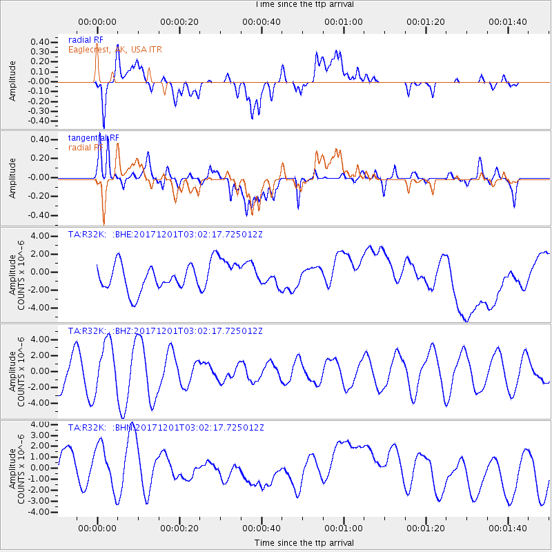
Signal To Noise
| Channel | StoN | STA | LTA |
| TA:R32K: :BHZ:20171201T03:02:17.725012Z | 1.9711453 | 3.127174E-6 | 1.5864756E-6 |
| TA:R32K: :BHN:20171201T03:02:17.725012Z | 1.4727768 | 2.1360784E-6 | 1.4503747E-6 |
| TA:R32K: :BHE:20171201T03:02:17.725012Z | 1.551883 | 2.0788525E-6 | 1.3395678E-6 |
| Arrivals |
| Ps | |
| PpPs | |
| PsPs/PpSs | |


