You are here: Home > Network List > UW - Pacific Northwest Regional Seismic Network Stations List
> Station LTY Liberty (broad-band) > Earthquake Result Viewer
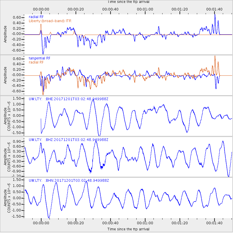
LTY Liberty (broad-band) - Earthquake Result Viewer
*The percent match for this event was below the threshold and hence no stack was calculated.
| Earthquake location: |
Eastern New Guinea Reg., P.N.G. |
| Earthquake latitude/longitude: |
-6.1/147.6 |
| Earthquake time(UTC): |
2017/12/01 (335) 02:49:59 GMT |
| Earthquake Depth: |
40 km |
| Earthquake Magnitude: |
6.0 Mww |
| Earthquake Catalog/Contributor: |
NEIC PDE/us |
|
| Network: |
UW Pacific Northwest Regional Seismic Network |
| Station: |
LTY Liberty (broad-band) |
| Lat/Lon: |
47.26 N/120.66 W |
| Elevation: |
970 m |
|
| Distance: |
95.6 deg |
| Az: |
43.169 deg |
| Baz: |
267.098 deg |
| Ray Param: |
$rayparam |
*The percent match for this event was below the threshold and hence was not used in the summary stack. |
|
| Radial Match: |
58.7947 % |
| Radial Bump: |
400 |
| Transverse Match: |
69.266075 % |
| Transverse Bump: |
400 |
| SOD ConfigId: |
13570011 |
| Insert Time: |
2019-04-29 08:46:29.337 +0000 |
| GWidth: |
2.5 |
| Max Bumps: |
400 |
| Tol: |
0.001 |
|
Signal To Noise
| Channel | StoN | STA | LTA |
| UW:LTY: :BHZ:20171201T03:02:48.949988Z | 1.9586608 | 5.6226855E-7 | 2.8706782E-7 |
| UW:LTY: :BHN:20171201T03:02:48.949988Z | 2.6847312 | 9.1550606E-7 | 3.4100475E-7 |
| UW:LTY: :BHE:20171201T03:02:48.949988Z | 1.974478 | 1.2208545E-6 | 6.1831764E-7 |
| Arrivals |
| Ps | |
| PpPs | |
| PsPs/PpSs | |


