You are here: Home > Network List > TA - USArray Transportable Network (new EarthScope stations) Stations List
> Station E18K Tukpahlearik Creek, AK, USA > Earthquake Result Viewer
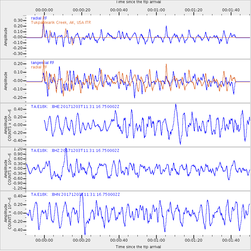
E18K Tukpahlearik Creek, AK, USA - Earthquake Result Viewer
*The percent match for this event was below the threshold and hence no stack was calculated.
| Earthquake location: |
Near Coast Of Ecuador |
| Earthquake latitude/longitude: |
-0.5/-80.3 |
| Earthquake time(UTC): |
2017/12/03 (337) 11:19:06 GMT |
| Earthquake Depth: |
25 km |
| Earthquake Magnitude: |
6.0 Mww |
| Earthquake Catalog/Contributor: |
NEIC PDE/us |
|
| Network: |
TA USArray Transportable Network (new EarthScope stations) |
| Station: |
E18K Tukpahlearik Creek, AK, USA |
| Lat/Lon: |
67.42 N/160.60 W |
| Elevation: |
297 m |
|
| Distance: |
86.7 deg |
| Az: |
337.587 deg |
| Baz: |
99.125 deg |
| Ray Param: |
$rayparam |
*The percent match for this event was below the threshold and hence was not used in the summary stack. |
|
| Radial Match: |
54.556675 % |
| Radial Bump: |
386 |
| Transverse Match: |
51.286922 % |
| Transverse Bump: |
400 |
| SOD ConfigId: |
13570011 |
| Insert Time: |
2019-04-29 08:57:39.530 +0000 |
| GWidth: |
2.5 |
| Max Bumps: |
400 |
| Tol: |
0.001 |
|
Signal To Noise
| Channel | StoN | STA | LTA |
| TA:E18K: :BHZ:20171203T11:31:16.750002Z | 2.494795 | 3.3714477E-7 | 1.3513926E-7 |
| TA:E18K: :BHN:20171203T11:31:16.750002Z | 0.8603678 | 1.3264392E-7 | 1.5417119E-7 |
| TA:E18K: :BHE:20171203T11:31:16.750002Z | 0.6265606 | 8.979289E-8 | 1.4331077E-7 |
| Arrivals |
| Ps | |
| PpPs | |
| PsPs/PpSs | |


