You are here: Home > Network List > TA - USArray Transportable Network (new EarthScope stations) Stations List
> Station R31K City Hall, Gustavus, AK, USA > Earthquake Result Viewer
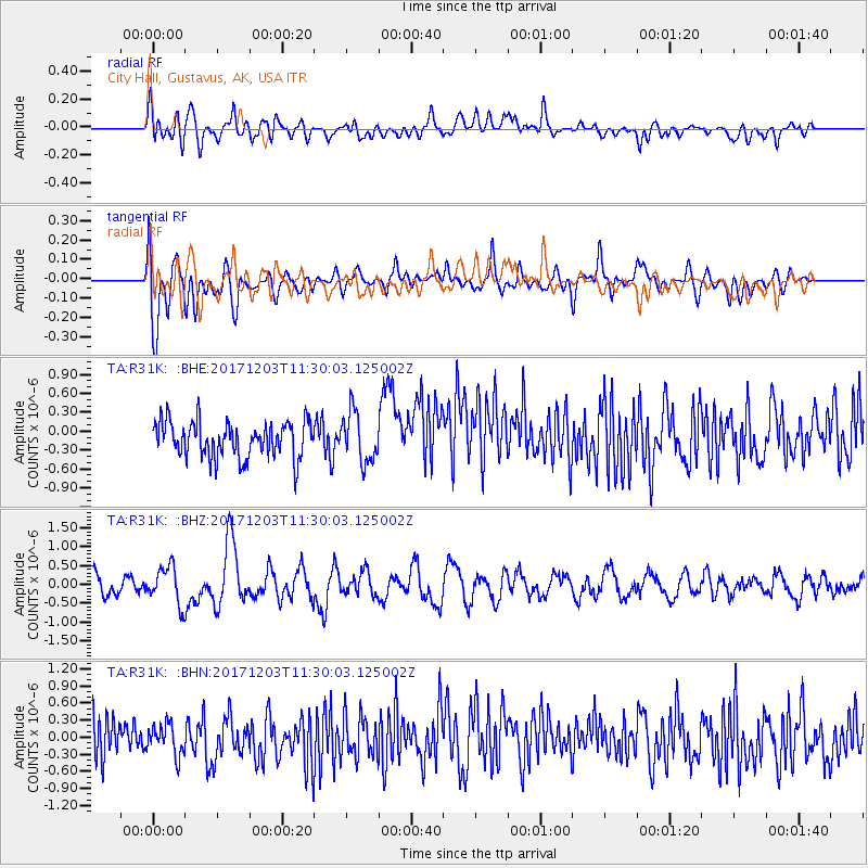
R31K City Hall, Gustavus, AK, USA - Earthquake Result Viewer
*The percent match for this event was below the threshold and hence no stack was calculated.
| Earthquake location: |
Near Coast Of Ecuador |
| Earthquake latitude/longitude: |
-0.5/-80.3 |
| Earthquake time(UTC): |
2017/12/03 (337) 11:19:06 GMT |
| Earthquake Depth: |
25 km |
| Earthquake Magnitude: |
6.0 Mww |
| Earthquake Catalog/Contributor: |
NEIC PDE/us |
|
| Network: |
TA USArray Transportable Network (new EarthScope stations) |
| Station: |
R31K City Hall, Gustavus, AK, USA |
| Lat/Lon: |
58.41 N/135.74 W |
| Elevation: |
15 m |
|
| Distance: |
73.1 deg |
| Az: |
333.05 deg |
| Baz: |
120.569 deg |
| Ray Param: |
$rayparam |
*The percent match for this event was below the threshold and hence was not used in the summary stack. |
|
| Radial Match: |
40.731457 % |
| Radial Bump: |
400 |
| Transverse Match: |
57.35893 % |
| Transverse Bump: |
400 |
| SOD ConfigId: |
13570011 |
| Insert Time: |
2019-04-29 08:58:53.788 +0000 |
| GWidth: |
2.5 |
| Max Bumps: |
400 |
| Tol: |
0.001 |
|
Signal To Noise
| Channel | StoN | STA | LTA |
| TA:R31K: :BHZ:20171203T11:30:03.125002Z | 1.7933667 | 4.901867E-7 | 2.7333326E-7 |
| TA:R31K: :BHN:20171203T11:30:03.125002Z | 0.8391395 | 2.6775209E-7 | 3.1907933E-7 |
| TA:R31K: :BHE:20171203T11:30:03.125002Z | 1.4265134 | 4.0393522E-7 | 2.831626E-7 |
| Arrivals |
| Ps | |
| PpPs | |
| PsPs/PpSs | |


