You are here: Home > Network List > AV - Alaska Volcano Observatory Stations List
> Station SPCR Ckakachatna River, Mount Spurr, Alaska > Earthquake Result Viewer
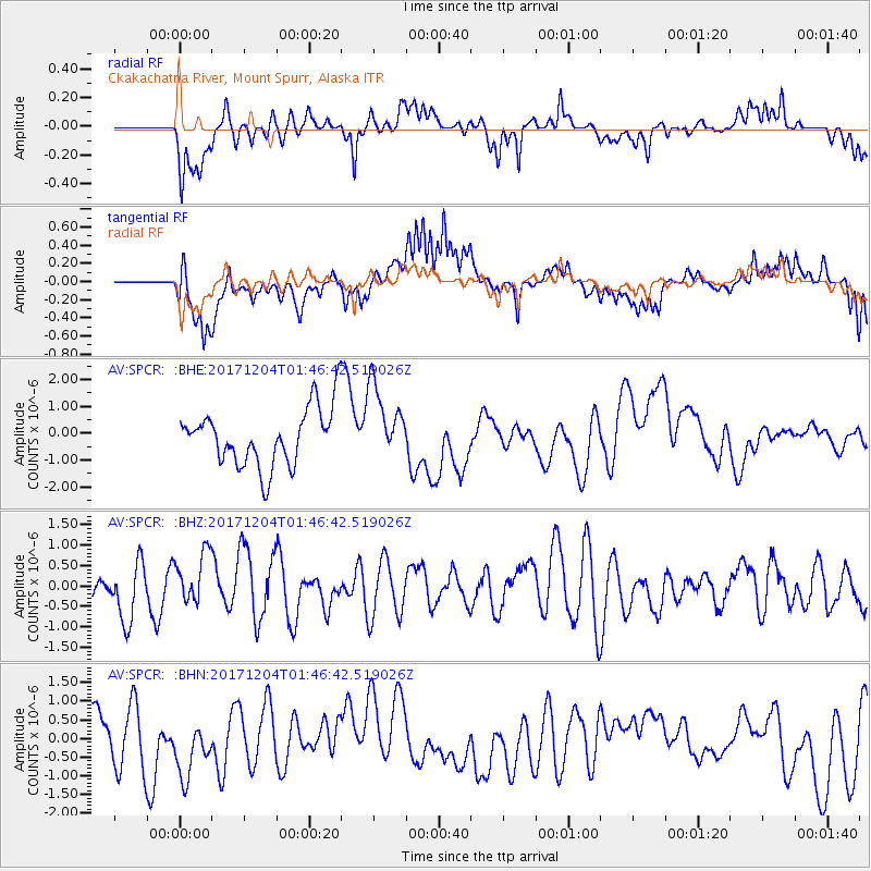
SPCR Ckakachatna River, Mount Spurr, Alaska - Earthquake Result Viewer
*The percent match for this event was below the threshold and hence no stack was calculated.
| Earthquake location: |
Vanuatu Islands Region |
| Earthquake latitude/longitude: |
-13.9/170.4 |
| Earthquake time(UTC): |
2017/12/04 (338) 01:35:01 GMT |
| Earthquake Depth: |
10 km |
| Earthquake Magnitude: |
5.5 Mww |
| Earthquake Catalog/Contributor: |
NEIC PDE/us |
|
| Network: |
AV Alaska Volcano Observatory |
| Station: |
SPCR Ckakachatna River, Mount Spurr, Alaska |
| Lat/Lon: |
61.20 N/152.21 W |
| Elevation: |
984 m |
|
| Distance: |
80.5 deg |
| Az: |
17.344 deg |
| Baz: |
216.71 deg |
| Ray Param: |
$rayparam |
*The percent match for this event was below the threshold and hence was not used in the summary stack. |
|
| Radial Match: |
67.09528 % |
| Radial Bump: |
400 |
| Transverse Match: |
62.67662 % |
| Transverse Bump: |
400 |
| SOD ConfigId: |
13570011 |
| Insert Time: |
2019-04-29 09:06:01.208 +0000 |
| GWidth: |
2.5 |
| Max Bumps: |
400 |
| Tol: |
0.001 |
|
Signal To Noise
| Channel | StoN | STA | LTA |
| AV:SPCR: :BHZ:20171204T01:46:42.519026Z | 1.0390344 | 6.5794615E-7 | 6.3322847E-7 |
| AV:SPCR: :BHN:20171204T01:46:42.519026Z | 1.2098547 | 8.271968E-7 | 6.837158E-7 |
| AV:SPCR: :BHE:20171204T01:46:42.519026Z | 1.2817119 | 1.3809107E-6 | 1.0773955E-6 |
| Arrivals |
| Ps | |
| PpPs | |
| PsPs/PpSs | |


