You are here: Home > Network List > TA - USArray Transportable Network (new EarthScope stations) Stations List
> Station J26L Joseph Creek, AK, USA > Earthquake Result Viewer
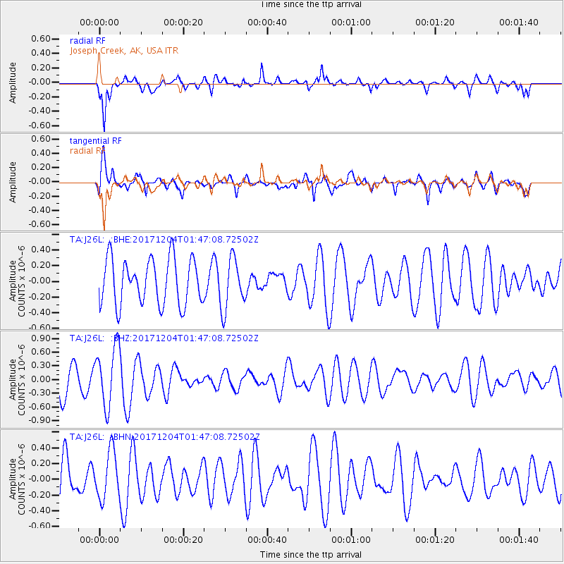
J26L Joseph Creek, AK, USA - Earthquake Result Viewer
*The percent match for this event was below the threshold and hence no stack was calculated.
| Earthquake location: |
Vanuatu Islands Region |
| Earthquake latitude/longitude: |
-13.9/170.4 |
| Earthquake time(UTC): |
2017/12/04 (338) 01:35:01 GMT |
| Earthquake Depth: |
10 km |
| Earthquake Magnitude: |
5.5 Mww |
| Earthquake Catalog/Contributor: |
NEIC PDE/us |
|
| Network: |
TA USArray Transportable Network (new EarthScope stations) |
| Station: |
J26L Joseph Creek, AK, USA |
| Lat/Lon: |
64.50 N/143.56 W |
| Elevation: |
1144 m |
|
| Distance: |
85.6 deg |
| Az: |
18.208 deg |
| Baz: |
224.503 deg |
| Ray Param: |
$rayparam |
*The percent match for this event was below the threshold and hence was not used in the summary stack. |
|
| Radial Match: |
60.18057 % |
| Radial Bump: |
400 |
| Transverse Match: |
60.261497 % |
| Transverse Bump: |
400 |
| SOD ConfigId: |
13570011 |
| Insert Time: |
2019-04-29 09:08:25.449 +0000 |
| GWidth: |
2.5 |
| Max Bumps: |
400 |
| Tol: |
0.001 |
|
Signal To Noise
| Channel | StoN | STA | LTA |
| TA:J26L: :BHZ:20171204T01:47:08.72502Z | 2.5104024 | 6.623932E-7 | 2.6385933E-7 |
| TA:J26L: :BHN:20171204T01:47:08.72502Z | 1.1293432 | 3.1434476E-7 | 2.7834298E-7 |
| TA:J26L: :BHE:20171204T01:47:08.72502Z | 1.1258271 | 3.2783905E-7 | 2.911984E-7 |
| Arrivals |
| Ps | |
| PpPs | |
| PsPs/PpSs | |


