You are here: Home > Network List > TA - USArray Transportable Network (new EarthScope stations) Stations List
> Station L20K Farewell, AK, USA > Earthquake Result Viewer
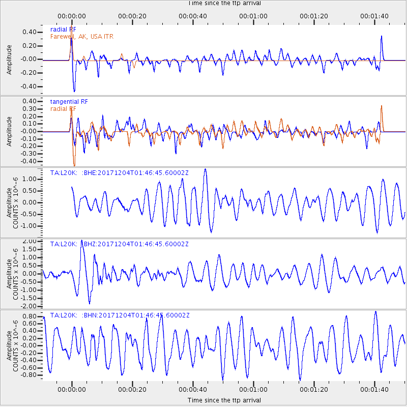
L20K Farewell, AK, USA - Earthquake Result Viewer
*The percent match for this event was below the threshold and hence no stack was calculated.
| Earthquake location: |
Vanuatu Islands Region |
| Earthquake latitude/longitude: |
-13.9/170.4 |
| Earthquake time(UTC): |
2017/12/04 (338) 01:35:01 GMT |
| Earthquake Depth: |
10 km |
| Earthquake Magnitude: |
5.5 Mww |
| Earthquake Catalog/Contributor: |
NEIC PDE/us |
|
| Network: |
TA USArray Transportable Network (new EarthScope stations) |
| Station: |
L20K Farewell, AK, USA |
| Lat/Lon: |
62.48 N/153.88 W |
| Elevation: |
673 m |
|
| Distance: |
81.1 deg |
| Az: |
15.932 deg |
| Baz: |
215.014 deg |
| Ray Param: |
$rayparam |
*The percent match for this event was below the threshold and hence was not used in the summary stack. |
|
| Radial Match: |
63.743088 % |
| Radial Bump: |
400 |
| Transverse Match: |
58.926563 % |
| Transverse Bump: |
400 |
| SOD ConfigId: |
13570011 |
| Insert Time: |
2019-04-29 09:08:28.541 +0000 |
| GWidth: |
2.5 |
| Max Bumps: |
400 |
| Tol: |
0.001 |
|
Signal To Noise
| Channel | StoN | STA | LTA |
| TA:L20K: :BHZ:20171204T01:46:45.60002Z | 3.3239186 | 1.0117994E-6 | 3.0439958E-7 |
| TA:L20K: :BHN:20171204T01:46:45.60002Z | 0.87609017 | 3.0879852E-7 | 3.5247345E-7 |
| TA:L20K: :BHE:20171204T01:46:45.60002Z | 2.2416968 | 6.485746E-7 | 2.8932305E-7 |
| Arrivals |
| Ps | |
| PpPs | |
| PsPs/PpSs | |


