You are here: Home > Network List > TA - USArray Transportable Network (new EarthScope stations) Stations List
> Station E18K Tukpahlearik Creek, AK, USA > Earthquake Result Viewer
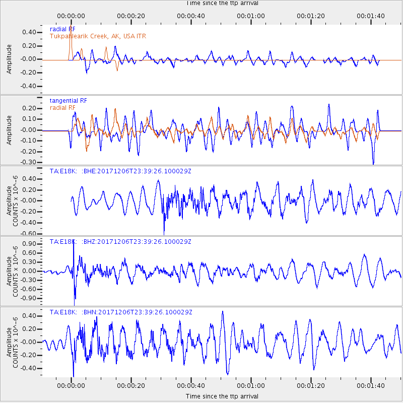
E18K Tukpahlearik Creek, AK, USA - Earthquake Result Viewer
*The percent match for this event was below the threshold and hence no stack was calculated.
| Earthquake location: |
Eastern Kashmir |
| Earthquake latitude/longitude: |
35.7/77.6 |
| Earthquake time(UTC): |
2017/12/06 (340) 23:29:02 GMT |
| Earthquake Depth: |
59 km |
| Earthquake Magnitude: |
5.1 Mww |
| Earthquake Catalog/Contributor: |
NEIC PDE/us |
|
| Network: |
TA USArray Transportable Network (new EarthScope stations) |
| Station: |
E18K Tukpahlearik Creek, AK, USA |
| Lat/Lon: |
67.42 N/160.60 W |
| Elevation: |
297 m |
|
| Distance: |
68.3 deg |
| Az: |
20.676 deg |
| Baz: |
311.886 deg |
| Ray Param: |
$rayparam |
*The percent match for this event was below the threshold and hence was not used in the summary stack. |
|
| Radial Match: |
43.700226 % |
| Radial Bump: |
369 |
| Transverse Match: |
51.1892 % |
| Transverse Bump: |
400 |
| SOD ConfigId: |
13570011 |
| Insert Time: |
2019-04-29 09:15:47.664 +0000 |
| GWidth: |
2.5 |
| Max Bumps: |
400 |
| Tol: |
0.001 |
|
Signal To Noise
| Channel | StoN | STA | LTA |
| TA:E18K: :BHZ:20171206T23:39:26.100029Z | 4.108 | 3.7671492E-7 | 9.1702766E-8 |
| TA:E18K: :BHN:20171206T23:39:26.100029Z | 2.1724277 | 1.8684356E-7 | 8.600681E-8 |
| TA:E18K: :BHE:20171206T23:39:26.100029Z | 1.6436077 | 2.1894485E-7 | 1.3320992E-7 |
| Arrivals |
| Ps | |
| PpPs | |
| PsPs/PpSs | |


