You are here: Home > Network List > TA - USArray Transportable Network (new EarthScope stations) Stations List
> Station J25K Salcha River, AK, USA > Earthquake Result Viewer
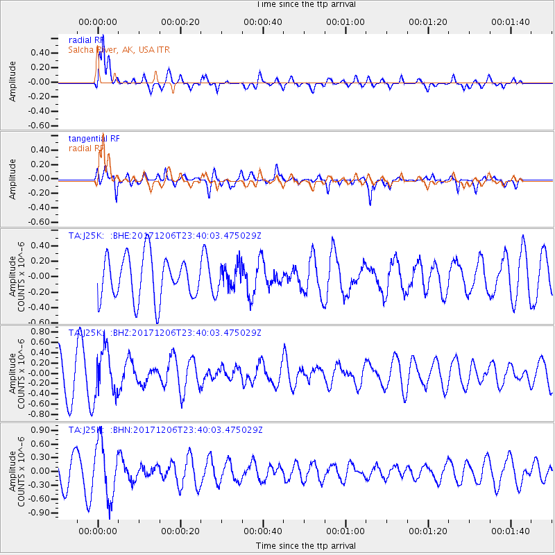
J25K Salcha River, AK, USA - Earthquake Result Viewer
*The percent match for this event was below the threshold and hence no stack was calculated.
| Earthquake location: |
Eastern Kashmir |
| Earthquake latitude/longitude: |
35.7/77.6 |
| Earthquake time(UTC): |
2017/12/06 (340) 23:29:02 GMT |
| Earthquake Depth: |
59 km |
| Earthquake Magnitude: |
5.1 Mww |
| Earthquake Catalog/Contributor: |
NEIC PDE/us |
|
| Network: |
TA USArray Transportable Network (new EarthScope stations) |
| Station: |
J25K Salcha River, AK, USA |
| Lat/Lon: |
64.61 N/145.37 W |
| Elevation: |
949 m |
|
| Distance: |
74.5 deg |
| Az: |
17.738 deg |
| Baz: |
324.868 deg |
| Ray Param: |
$rayparam |
*The percent match for this event was below the threshold and hence was not used in the summary stack. |
|
| Radial Match: |
81.85356 % |
| Radial Bump: |
400 |
| Transverse Match: |
44.464767 % |
| Transverse Bump: |
391 |
| SOD ConfigId: |
13570011 |
| Insert Time: |
2019-04-29 09:16:03.882 +0000 |
| GWidth: |
2.5 |
| Max Bumps: |
400 |
| Tol: |
0.001 |
|
Signal To Noise
| Channel | StoN | STA | LTA |
| TA:J25K: :BHZ:20171206T23:40:03.475029Z | 1.3727257 | 4.3084276E-7 | 3.1385932E-7 |
| TA:J25K: :BHN:20171206T23:40:03.475029Z | 2.6215982 | 6.096161E-7 | 2.3253604E-7 |
| TA:J25K: :BHE:20171206T23:40:03.475029Z | 0.5306246 | 1.4808971E-7 | 2.7908564E-7 |
| Arrivals |
| Ps | |
| PpPs | |
| PsPs/PpSs | |


