You are here: Home > Network List > IU - Global Seismograph Network (GSN - IRIS/USGS) Stations List
> Station CCM Cathedral Cave, Missouri, USA > Earthquake Result Viewer
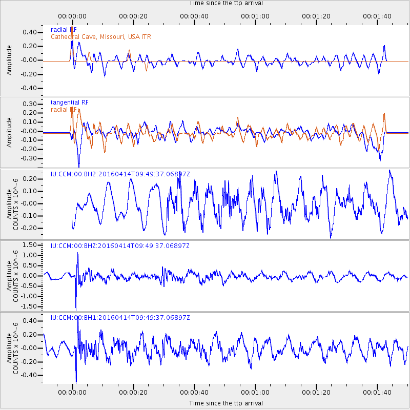
CCM Cathedral Cave, Missouri, USA - Earthquake Result Viewer
*The percent match for this event was below the threshold and hence no stack was calculated.
| Earthquake location: |
Chile-Argentina Border Region |
| Earthquake latitude/longitude: |
-33.9/-70.4 |
| Earthquake time(UTC): |
2016/04/14 (105) 09:38:44 GMT |
| Earthquake Depth: |
112 km |
| Earthquake Magnitude: |
5.5 MB |
| Earthquake Catalog/Contributor: |
NEIC PDE/NEIC ALERT |
|
| Network: |
IU Global Seismograph Network (GSN - IRIS/USGS) |
| Station: |
CCM Cathedral Cave, Missouri, USA |
| Lat/Lon: |
38.06 N/91.24 W |
| Elevation: |
222 m |
|
| Distance: |
74.1 deg |
| Az: |
343.039 deg |
| Baz: |
162.089 deg |
| Ray Param: |
$rayparam |
*The percent match for this event was below the threshold and hence was not used in the summary stack. |
|
| Radial Match: |
61.174862 % |
| Radial Bump: |
400 |
| Transverse Match: |
57.823387 % |
| Transverse Bump: |
400 |
| SOD ConfigId: |
1475611 |
| Insert Time: |
2016-04-28 09:50:39.955 +0000 |
| GWidth: |
2.5 |
| Max Bumps: |
400 |
| Tol: |
0.001 |
|
Signal To Noise
| Channel | StoN | STA | LTA |
| IU:CCM:00:BHZ:20160414T09:49:37.06897Z | 2.9095278 | 4.0855693E-7 | 1.4042035E-7 |
| IU:CCM:00:BH1:20160414T09:49:37.06897Z | 1.3269165 | 1.5514983E-7 | 1.169251E-7 |
| IU:CCM:00:BH2:20160414T09:49:37.06897Z | 1.2530465 | 1.297059E-7 | 1.03512434E-7 |
| Arrivals |
| Ps | |
| PpPs | |
| PsPs/PpSs | |


