You are here: Home > Network List > CI - Caltech Regional Seismic Network Stations List
> Station RPV Rancho Palos Verdes, California, USA > Earthquake Result Viewer
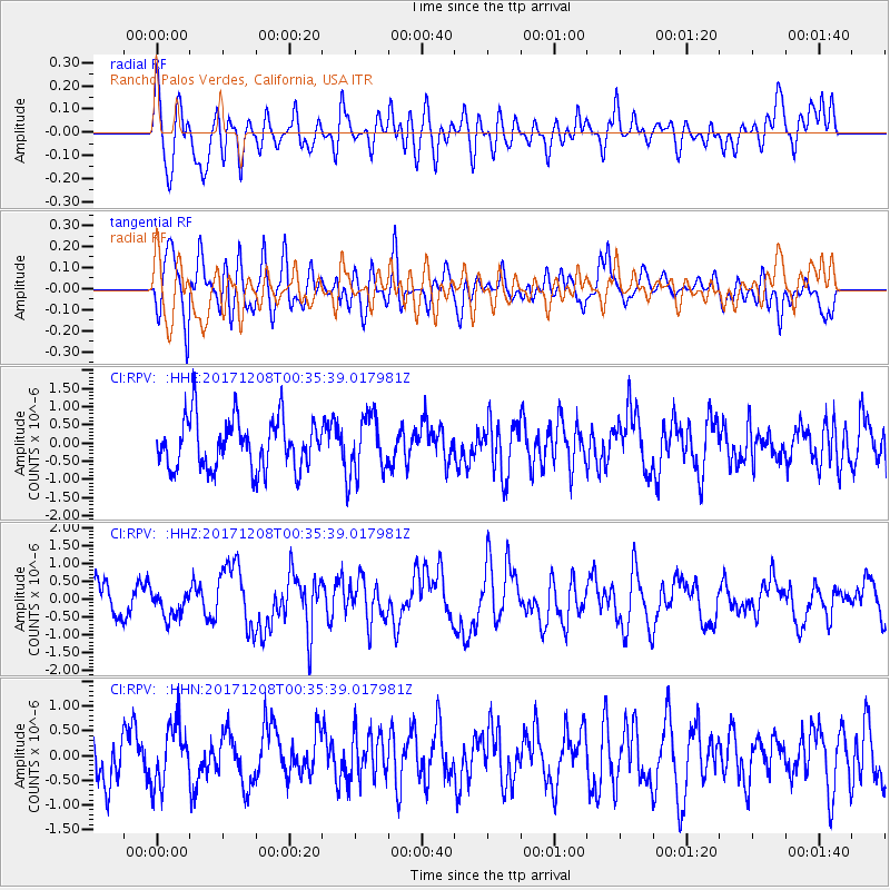
RPV Rancho Palos Verdes, California, USA - Earthquake Result Viewer
*The percent match for this event was below the threshold and hence no stack was calculated.
| Earthquake location: |
W. Caroline Islands, Micronesia |
| Earthquake latitude/longitude: |
10.1/140.2 |
| Earthquake time(UTC): |
2017/12/08 (342) 00:22:53 GMT |
| Earthquake Depth: |
7.5 km |
| Earthquake Magnitude: |
6.5 mww |
| Earthquake Catalog/Contributor: |
NEIC PDE/us |
|
| Network: |
CI Caltech Regional Seismic Network |
| Station: |
RPV Rancho Palos Verdes, California, USA |
| Lat/Lon: |
33.74 N/118.40 W |
| Elevation: |
64 m |
|
| Distance: |
93.7 deg |
| Az: |
54.943 deg |
| Baz: |
284.707 deg |
| Ray Param: |
$rayparam |
*The percent match for this event was below the threshold and hence was not used in the summary stack. |
|
| Radial Match: |
45.749447 % |
| Radial Bump: |
400 |
| Transverse Match: |
65.30337 % |
| Transverse Bump: |
400 |
| SOD ConfigId: |
13570011 |
| Insert Time: |
2019-04-29 09:18:49.082 +0000 |
| GWidth: |
2.5 |
| Max Bumps: |
400 |
| Tol: |
0.001 |
|
Signal To Noise
| Channel | StoN | STA | LTA |
| CI:RPV: :HHZ:20171208T00:35:39.017981Z | 0.84153056 | 3.5891372E-7 | 4.2650112E-7 |
| CI:RPV: :HHN:20171208T00:35:39.017981Z | 1.0393761 | 6.32901E-7 | 6.089239E-7 |
| CI:RPV: :HHE:20171208T00:35:39.017981Z | 1.1177512 | 7.64028E-7 | 6.835403E-7 |
| Arrivals |
| Ps | |
| PpPs | |
| PsPs/PpSs | |


