You are here: Home > Network List > AZ - ANZA Regional Network Stations List
> Station FRD AZ.FRD > Earthquake Result Viewer
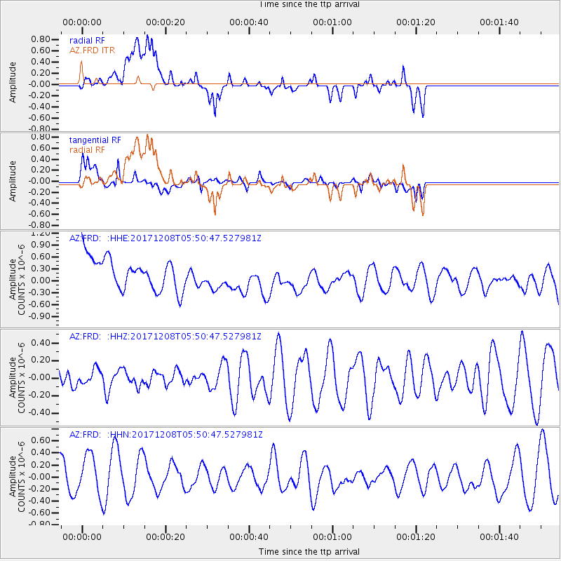
FRD AZ.FRD - Earthquake Result Viewer
*The percent match for this event was below the threshold and hence no stack was calculated.
| Earthquake location: |
W. Caroline Islands, Micronesia |
| Earthquake latitude/longitude: |
10.0/140.1 |
| Earthquake time(UTC): |
2017/12/08 (342) 05:37:54 GMT |
| Earthquake Depth: |
10 km |
| Earthquake Magnitude: |
5.5 mb |
| Earthquake Catalog/Contributor: |
NEIC PDE/us |
|
| Network: |
AZ ANZA Regional Network |
| Station: |
FRD AZ.FRD |
| Lat/Lon: |
33.49 N/116.60 W |
| Elevation: |
1164 m |
|
| Distance: |
95.4 deg |
| Az: |
54.781 deg |
| Baz: |
285.628 deg |
| Ray Param: |
$rayparam |
*The percent match for this event was below the threshold and hence was not used in the summary stack. |
|
| Radial Match: |
54.97196 % |
| Radial Bump: |
400 |
| Transverse Match: |
44.57829 % |
| Transverse Bump: |
400 |
| SOD ConfigId: |
13570011 |
| Insert Time: |
2019-04-29 09:28:22.805 +0000 |
| GWidth: |
2.5 |
| Max Bumps: |
400 |
| Tol: |
0.001 |
|
Signal To Noise
| Channel | StoN | STA | LTA |
| AZ:FRD: :HHZ:20171208T05:50:47.527981Z | 0.45337203 | 8.3213855E-8 | 1.835443E-7 |
| AZ:FRD: :HHN:20171208T05:50:47.527981Z | 1.4921027 | 3.4503333E-7 | 2.3123965E-7 |
| AZ:FRD: :HHE:20171208T05:50:47.527981Z | 0.83590007 | 3.2394473E-7 | 3.8754004E-7 |
| Arrivals |
| Ps | |
| PpPs | |
| PsPs/PpSs | |


