You are here: Home > Network List > AK - Alaska Regional Network Stations List
> Station GAMB Gambell Broadband > Earthquake Result Viewer
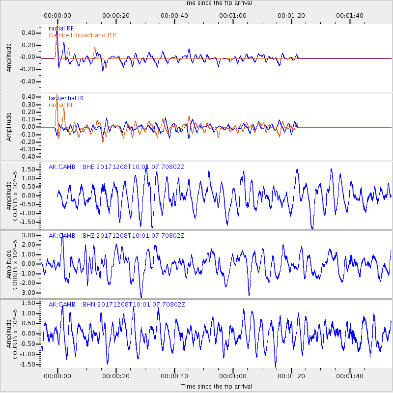
GAMB Gambell Broadband - Earthquake Result Viewer
*The percent match for this event was below the threshold and hence no stack was calculated.
| Earthquake location: |
W. Caroline Islands, Micronesia |
| Earthquake latitude/longitude: |
10.0/140.1 |
| Earthquake time(UTC): |
2017/12/08 (342) 09:51:10 GMT |
| Earthquake Depth: |
20 km |
| Earthquake Magnitude: |
6.4 Mww |
| Earthquake Catalog/Contributor: |
NEIC PDE/us |
|
| Network: |
AK Alaska Regional Network |
| Station: |
GAMB Gambell Broadband |
| Lat/Lon: |
63.78 N/171.70 W |
| Elevation: |
10 m |
|
| Distance: |
63.5 deg |
| Az: |
21.713 deg |
| Baz: |
235.108 deg |
| Ray Param: |
$rayparam |
*The percent match for this event was below the threshold and hence was not used in the summary stack. |
|
| Radial Match: |
73.227264 % |
| Radial Bump: |
400 |
| Transverse Match: |
40.17304 % |
| Transverse Bump: |
400 |
| SOD ConfigId: |
13570011 |
| Insert Time: |
2019-04-29 09:32:22.882 +0000 |
| GWidth: |
2.5 |
| Max Bumps: |
400 |
| Tol: |
0.001 |
|
Signal To Noise
| Channel | StoN | STA | LTA |
| AK:GAMB: :BHZ:20171208T10:01:07.70802Z | 1.5435121 | 1.337975E-6 | 8.668381E-7 |
| AK:GAMB: :BHN:20171208T10:01:07.70802Z | 1.9260327 | 7.145817E-7 | 3.7101225E-7 |
| AK:GAMB: :BHE:20171208T10:01:07.70802Z | 2.131304 | 1.0728015E-6 | 5.033545E-7 |
| Arrivals |
| Ps | |
| PpPs | |
| PsPs/PpSs | |


