You are here: Home > Network List > AZ - ANZA Regional Network Stations List
> Station LVA2 AZ.LVA2 > Earthquake Result Viewer
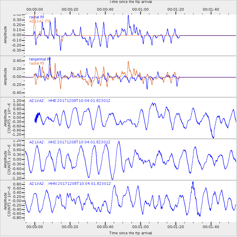
LVA2 AZ.LVA2 - Earthquake Result Viewer
*The percent match for this event was below the threshold and hence no stack was calculated.
| Earthquake location: |
W. Caroline Islands, Micronesia |
| Earthquake latitude/longitude: |
10.0/140.1 |
| Earthquake time(UTC): |
2017/12/08 (342) 09:51:10 GMT |
| Earthquake Depth: |
20 km |
| Earthquake Magnitude: |
6.4 Mww |
| Earthquake Catalog/Contributor: |
NEIC PDE/us |
|
| Network: |
AZ ANZA Regional Network |
| Station: |
LVA2 AZ.LVA2 |
| Lat/Lon: |
33.35 N/116.56 W |
| Elevation: |
1435 m |
|
| Distance: |
95.5 deg |
| Az: |
54.91 deg |
| Baz: |
285.653 deg |
| Ray Param: |
$rayparam |
*The percent match for this event was below the threshold and hence was not used in the summary stack. |
|
| Radial Match: |
47.22693 % |
| Radial Bump: |
400 |
| Transverse Match: |
67.854614 % |
| Transverse Bump: |
363 |
| SOD ConfigId: |
13570011 |
| Insert Time: |
2019-04-29 09:33:28.369 +0000 |
| GWidth: |
2.5 |
| Max Bumps: |
400 |
| Tol: |
0.001 |
|
Signal To Noise
| Channel | StoN | STA | LTA |
| AZ:LVA2: :HHZ:20171208T10:04:01.82301Z | 2.0742917 | 5.7715283E-7 | 2.7824092E-7 |
| AZ:LVA2: :HHN:20171208T10:04:01.82301Z | 1.3671514 | 3.7450502E-7 | 2.739309E-7 |
| AZ:LVA2: :HHE:20171208T10:04:01.82301Z | 1.5246282 | 5.4907525E-7 | 3.6013716E-7 |
| Arrivals |
| Ps | |
| PpPs | |
| PsPs/PpSs | |


