You are here: Home > Network List > CI - Caltech Regional Seismic Network Stations List
> Station BAR Barrett, Tecate, CA, USA > Earthquake Result Viewer
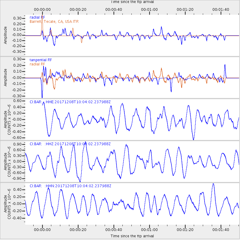
BAR Barrett, Tecate, CA, USA - Earthquake Result Viewer
*The percent match for this event was below the threshold and hence no stack was calculated.
| Earthquake location: |
W. Caroline Islands, Micronesia |
| Earthquake latitude/longitude: |
10.0/140.1 |
| Earthquake time(UTC): |
2017/12/08 (342) 09:51:10 GMT |
| Earthquake Depth: |
20 km |
| Earthquake Magnitude: |
6.4 Mww |
| Earthquake Catalog/Contributor: |
NEIC PDE/us |
|
| Network: |
CI Caltech Regional Seismic Network |
| Station: |
BAR Barrett, Tecate, CA, USA |
| Lat/Lon: |
32.68 N/116.67 W |
| Elevation: |
521 m |
|
| Distance: |
95.6 deg |
| Az: |
55.583 deg |
| Baz: |
285.528 deg |
| Ray Param: |
$rayparam |
*The percent match for this event was below the threshold and hence was not used in the summary stack. |
|
| Radial Match: |
60.888786 % |
| Radial Bump: |
400 |
| Transverse Match: |
62.628384 % |
| Transverse Bump: |
400 |
| SOD ConfigId: |
13570011 |
| Insert Time: |
2019-04-29 09:33:53.510 +0000 |
| GWidth: |
2.5 |
| Max Bumps: |
400 |
| Tol: |
0.001 |
|
Signal To Noise
| Channel | StoN | STA | LTA |
| CI:BAR: :HHZ:20171208T10:04:02.237988Z | 1.3751903 | 3.1729934E-7 | 2.3073123E-7 |
| CI:BAR: :HHN:20171208T10:04:02.237988Z | 1.7575015 | 3.1729397E-7 | 1.8053696E-7 |
| CI:BAR: :HHE:20171208T10:04:02.237988Z | 0.21213986 | 5.2172197E-8 | 2.4593302E-7 |
| Arrivals |
| Ps | |
| PpPs | |
| PsPs/PpSs | |


