You are here: Home > Network List > CI - Caltech Regional Seismic Network Stations List
> Station BFS Mt Baldy Forest Station > Earthquake Result Viewer
BFS Mt Baldy Forest Station - Earthquake Result Viewer
*The percent match for this event was below the threshold and hence no stack was calculated.
| Earthquake location: |
W. Caroline Islands, Micronesia |
| Earthquake latitude/longitude: |
10.0/140.1 |
| Earthquake time(UTC): |
2017/12/08 (342) 09:51:10 GMT |
| Earthquake Depth: |
20 km |
| Earthquake Magnitude: |
6.4 Mww |
| Earthquake Catalog/Contributor: |
NEIC PDE/us |
|
| Network: |
CI Caltech Regional Seismic Network |
| Station: |
BFS Mt Baldy Forest Station |
| Lat/Lon: |
34.24 N/117.66 W |
| Elevation: |
1312 m |
|
| Distance: |
94.4 deg |
| Az: |
54.297 deg |
| Baz: |
285.098 deg |
| Ray Param: |
$rayparam |
*The percent match for this event was below the threshold and hence was not used in the summary stack. |
|
| Radial Match: |
23.847942 % |
| Radial Bump: |
400 |
| Transverse Match: |
19.87152 % |
| Transverse Bump: |
400 |
| SOD ConfigId: |
13570011 |
| Insert Time: |
2019-04-29 09:33:54.720 +0000 |
| GWidth: |
2.5 |
| Max Bumps: |
400 |
| Tol: |
0.001 |
|
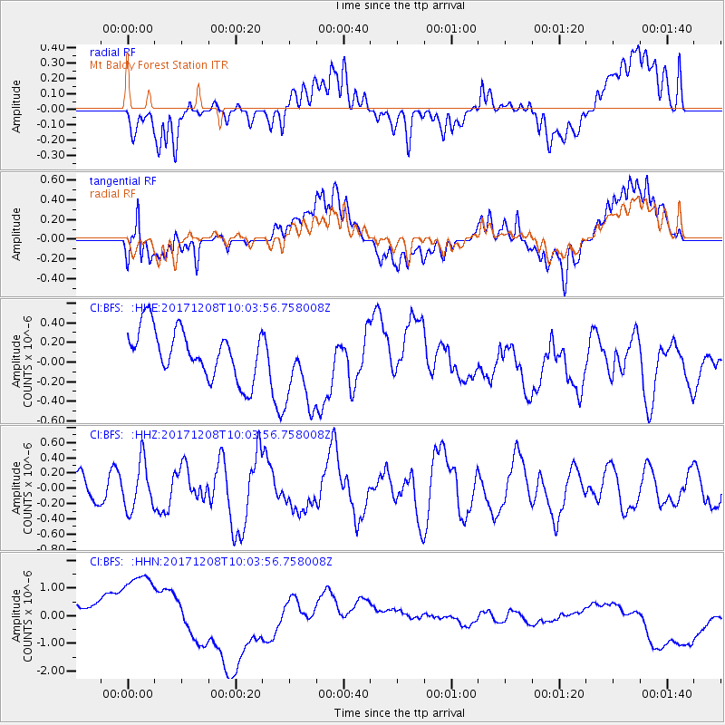
Signal To Noise
| Channel | StoN | STA | LTA |
| CI:BFS: :HHZ:20171208T10:03:56.758008Z | 1.3101896 | 3.1440857E-7 | 2.3997183E-7 |
| CI:BFS: :HHN:20171208T10:03:56.758008Z | 2.6832056 | 1.8067844E-6 | 6.733679E-7 |
| CI:BFS: :HHE:20171208T10:03:56.758008Z | 1.6776712 | 4.159357E-7 | 2.4792445E-7 |
| Arrivals |
| Ps | |
| PpPs | |
| PsPs/PpSs | |


