You are here: Home > Network List > CI - Caltech Regional Seismic Network Stations List
> Station MPM Manuel Prospect Mine, California, USA > Earthquake Result Viewer
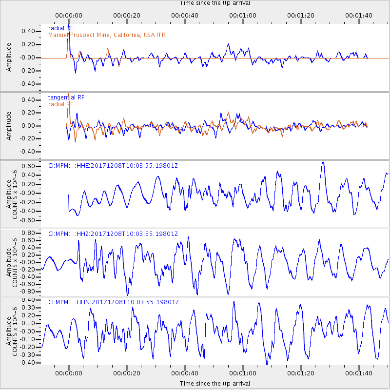
MPM Manuel Prospect Mine, California, USA - Earthquake Result Viewer
*The percent match for this event was below the threshold and hence no stack was calculated.
| Earthquake location: |
W. Caroline Islands, Micronesia |
| Earthquake latitude/longitude: |
10.0/140.1 |
| Earthquake time(UTC): |
2017/12/08 (342) 09:51:10 GMT |
| Earthquake Depth: |
20 km |
| Earthquake Magnitude: |
6.4 Mww |
| Earthquake Catalog/Contributor: |
NEIC PDE/us |
|
| Network: |
CI Caltech Regional Seismic Network |
| Station: |
MPM Manuel Prospect Mine, California, USA |
| Lat/Lon: |
36.06 N/117.49 W |
| Elevation: |
185 m |
|
| Distance: |
94.0 deg |
| Az: |
52.504 deg |
| Baz: |
285.326 deg |
| Ray Param: |
$rayparam |
*The percent match for this event was below the threshold and hence was not used in the summary stack. |
|
| Radial Match: |
58.999245 % |
| Radial Bump: |
400 |
| Transverse Match: |
56.797962 % |
| Transverse Bump: |
400 |
| SOD ConfigId: |
13570011 |
| Insert Time: |
2019-04-29 09:34:06.976 +0000 |
| GWidth: |
2.5 |
| Max Bumps: |
400 |
| Tol: |
0.001 |
|
Signal To Noise
| Channel | StoN | STA | LTA |
| CI:MPM: :HHZ:20171208T10:03:55.19801Z | 2.4411967 | 2.4441422E-7 | 1.00120666E-7 |
| CI:MPM: :HHN:20171208T10:03:55.19801Z | 1.2129414 | 1.993667E-7 | 1.643663E-7 |
| CI:MPM: :HHE:20171208T10:03:55.19801Z | 1.5105895 | 2.909326E-7 | 1.9259542E-7 |
| Arrivals |
| Ps | |
| PpPs | |
| PsPs/PpSs | |


