You are here: Home > Network List > CN - Canadian National Seismograph Network Stations List
> Station INK INUVIK, NT > Earthquake Result Viewer
INK INUVIK, NT - Earthquake Result Viewer
*The percent match for this event was below the threshold and hence no stack was calculated.
| Earthquake location: |
W. Caroline Islands, Micronesia |
| Earthquake latitude/longitude: |
10.0/140.1 |
| Earthquake time(UTC): |
2017/12/08 (342) 09:51:10 GMT |
| Earthquake Depth: |
20 km |
| Earthquake Magnitude: |
6.4 Mww |
| Earthquake Catalog/Contributor: |
NEIC PDE/us |
|
| Network: |
CN Canadian National Seismograph Network |
| Station: |
INK INUVIK, NT |
| Lat/Lon: |
68.31 N/133.53 W |
| Elevation: |
44 m |
|
| Distance: |
79.4 deg |
| Az: |
22.176 deg |
| Baz: |
270.343 deg |
| Ray Param: |
$rayparam |
*The percent match for this event was below the threshold and hence was not used in the summary stack. |
|
| Radial Match: |
35.54376 % |
| Radial Bump: |
400 |
| Transverse Match: |
53.673016 % |
| Transverse Bump: |
400 |
| SOD ConfigId: |
13570011 |
| Insert Time: |
2019-04-29 09:34:35.917 +0000 |
| GWidth: |
2.5 |
| Max Bumps: |
400 |
| Tol: |
0.001 |
|
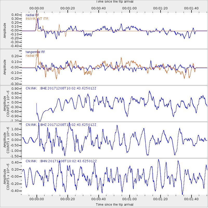
Signal To Noise
| Channel | StoN | STA | LTA |
| CN:INK: :BHZ:20171208T10:02:43.625012Z | 2.0059865 | 5.879154E-7 | 2.9308043E-7 |
| CN:INK: :BHN:20171208T10:02:43.625012Z | 0.65431815 | 1.3639249E-7 | 2.0844979E-7 |
| CN:INK: :BHE:20171208T10:02:43.625012Z | 1.2355633 | 4.965975E-7 | 4.0191995E-7 |
| Arrivals |
| Ps | |
| PpPs | |
| PsPs/PpSs | |


