You are here: Home > Network List > TA - USArray Transportable Network (new EarthScope stations) Stations List
> Station L29M Grand Valley Creek, YT, CAN > Earthquake Result Viewer
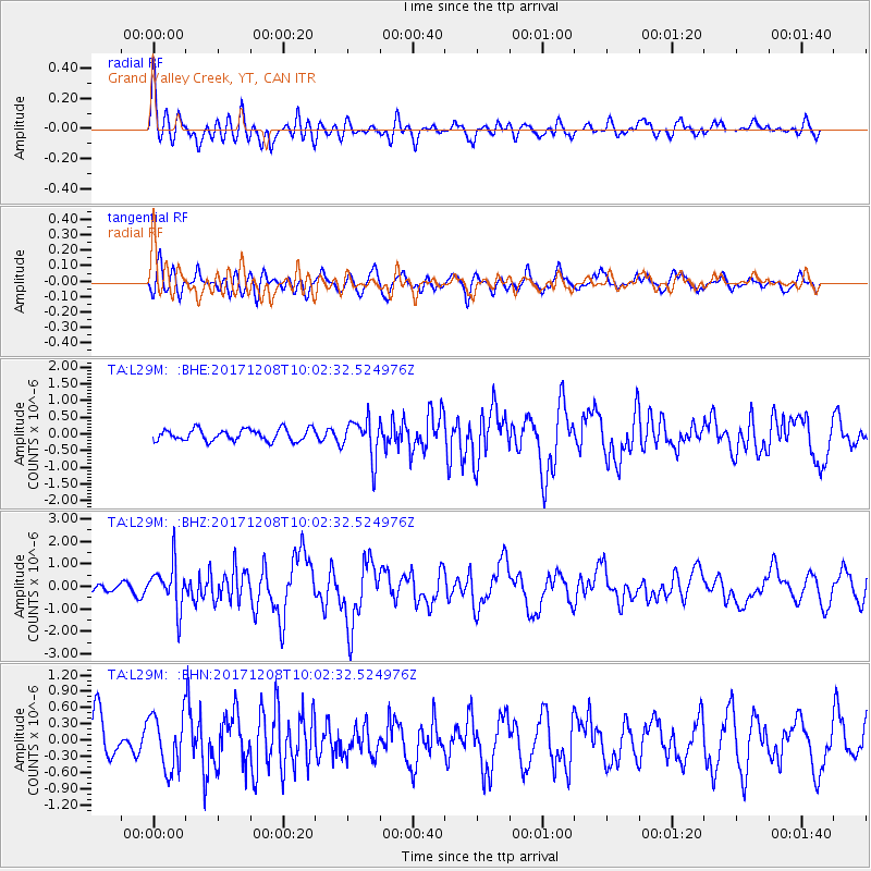
L29M Grand Valley Creek, YT, CAN - Earthquake Result Viewer
*The percent match for this event was below the threshold and hence no stack was calculated.
| Earthquake location: |
W. Caroline Islands, Micronesia |
| Earthquake latitude/longitude: |
10.0/140.1 |
| Earthquake time(UTC): |
2017/12/08 (342) 09:51:10 GMT |
| Earthquake Depth: |
20 km |
| Earthquake Magnitude: |
6.4 Mww |
| Earthquake Catalog/Contributor: |
NEIC PDE/us |
|
| Network: |
TA USArray Transportable Network (new EarthScope stations) |
| Station: |
L29M Grand Valley Creek, YT, CAN |
| Lat/Lon: |
63.11 N/138.13 W |
| Elevation: |
918 m |
|
| Distance: |
77.4 deg |
| Az: |
27.458 deg |
| Baz: |
267.209 deg |
| Ray Param: |
$rayparam |
*The percent match for this event was below the threshold and hence was not used in the summary stack. |
|
| Radial Match: |
75.161545 % |
| Radial Bump: |
400 |
| Transverse Match: |
71.04175 % |
| Transverse Bump: |
400 |
| SOD ConfigId: |
13570011 |
| Insert Time: |
2019-04-29 09:37:54.397 +0000 |
| GWidth: |
2.5 |
| Max Bumps: |
400 |
| Tol: |
0.001 |
|
Signal To Noise
| Channel | StoN | STA | LTA |
| TA:L29M: :BHZ:20171208T10:02:32.524976Z | 2.1668828 | 9.768934E-7 | 4.508289E-7 |
| TA:L29M: :BHN:20171208T10:02:32.524976Z | 1.3954921 | 5.145444E-7 | 3.68719E-7 |
| TA:L29M: :BHE:20171208T10:02:32.524976Z | 3.261024 | 5.7533356E-7 | 1.7642726E-7 |
| Arrivals |
| Ps | |
| PpPs | |
| PsPs/PpSs | |


