You are here: Home > Network List > UW - Pacific Northwest Regional Seismic Network Stations List
> Station FISH Seaside, OR, USA > Earthquake Result Viewer
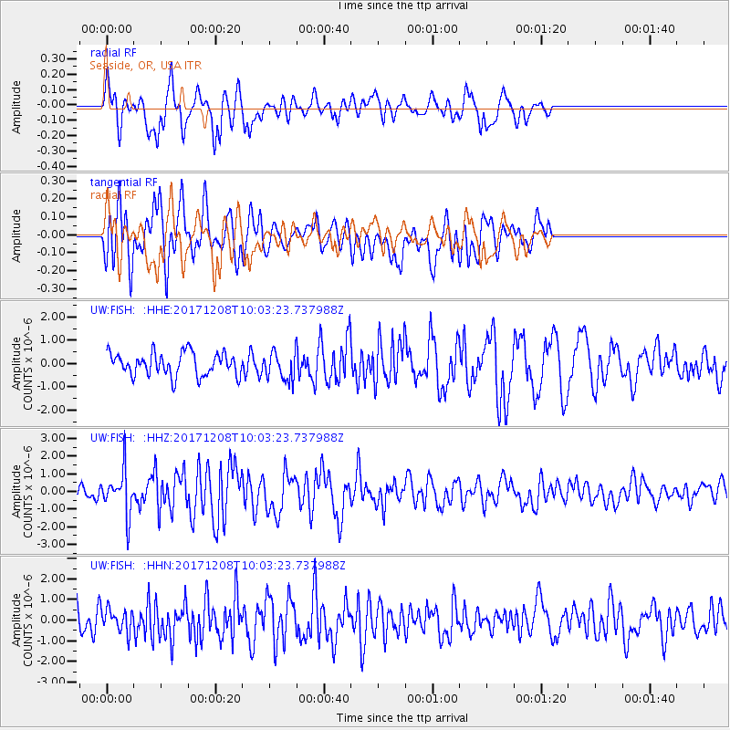
FISH Seaside, OR, USA - Earthquake Result Viewer
*The percent match for this event was below the threshold and hence no stack was calculated.
| Earthquake location: |
W. Caroline Islands, Micronesia |
| Earthquake latitude/longitude: |
10.0/140.1 |
| Earthquake time(UTC): |
2017/12/08 (342) 09:51:10 GMT |
| Earthquake Depth: |
20 km |
| Earthquake Magnitude: |
6.4 Mww |
| Earthquake Catalog/Contributor: |
NEIC PDE/us |
|
| Network: |
UW Pacific Northwest Regional Seismic Network |
| Station: |
FISH Seaside, OR, USA |
| Lat/Lon: |
45.93 N/123.56 W |
| Elevation: |
325 m |
|
| Distance: |
87.2 deg |
| Az: |
43.989 deg |
| Baz: |
281.436 deg |
| Ray Param: |
$rayparam |
*The percent match for this event was below the threshold and hence was not used in the summary stack. |
|
| Radial Match: |
65.38222 % |
| Radial Bump: |
400 |
| Transverse Match: |
67.28751 % |
| Transverse Bump: |
400 |
| SOD ConfigId: |
13570011 |
| Insert Time: |
2019-04-29 09:39:05.250 +0000 |
| GWidth: |
2.5 |
| Max Bumps: |
400 |
| Tol: |
0.001 |
|
Signal To Noise
| Channel | StoN | STA | LTA |
| UW:FISH: :HHZ:20171208T10:03:23.737988Z | 3.4947388 | 1.2227863E-6 | 3.4989347E-7 |
| UW:FISH: :HHN:20171208T10:03:23.737988Z | 0.8225738 | 5.369937E-7 | 6.528213E-7 |
| UW:FISH: :HHE:20171208T10:03:23.737988Z | 1.2219636 | 6.016944E-7 | 4.923996E-7 |
| Arrivals |
| Ps | |
| PpPs | |
| PsPs/PpSs | |


