You are here: Home > Network List > UW - Pacific Northwest Regional Seismic Network Stations List
> Station LCCR Mulino, OR, USA > Earthquake Result Viewer
LCCR Mulino, OR, USA - Earthquake Result Viewer
*The percent match for this event was below the threshold and hence no stack was calculated.
| Earthquake location: |
W. Caroline Islands, Micronesia |
| Earthquake latitude/longitude: |
10.0/140.1 |
| Earthquake time(UTC): |
2017/12/08 (342) 09:51:10 GMT |
| Earthquake Depth: |
20 km |
| Earthquake Magnitude: |
6.4 Mww |
| Earthquake Catalog/Contributor: |
NEIC PDE/us |
|
| Network: |
UW Pacific Northwest Regional Seismic Network |
| Station: |
LCCR Mulino, OR, USA |
| Lat/Lon: |
45.21 N/122.48 W |
| Elevation: |
273 m |
|
| Distance: |
88.1 deg |
| Az: |
44.543 deg |
| Baz: |
282.227 deg |
| Ray Param: |
$rayparam |
*The percent match for this event was below the threshold and hence was not used in the summary stack. |
|
| Radial Match: |
59.26398 % |
| Radial Bump: |
400 |
| Transverse Match: |
71.138824 % |
| Transverse Bump: |
400 |
| SOD ConfigId: |
13570011 |
| Insert Time: |
2019-04-29 09:39:11.076 +0000 |
| GWidth: |
2.5 |
| Max Bumps: |
400 |
| Tol: |
0.001 |
|
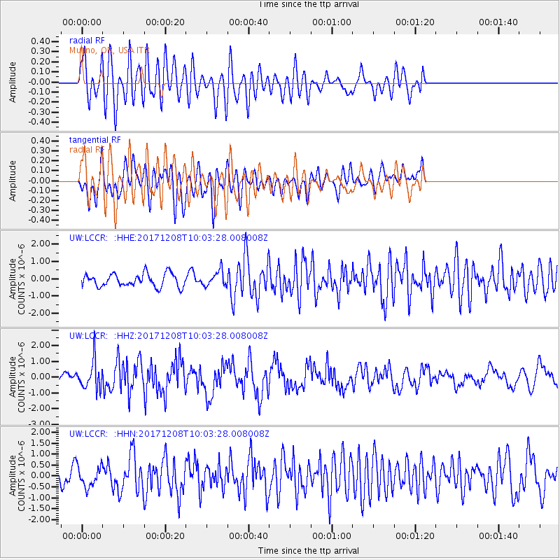
Signal To Noise
| Channel | StoN | STA | LTA |
| UW:LCCR: :HHZ:20171208T10:03:28.008008Z | 5.2575903 | 9.1053033E-7 | 1.7318396E-7 |
| UW:LCCR: :HHN:20171208T10:03:28.008008Z | 1.2279359 | 4.4961357E-7 | 3.6615393E-7 |
| UW:LCCR: :HHE:20171208T10:03:28.008008Z | 1.2056408 | 4.545566E-7 | 3.770249E-7 |
| Arrivals |
| Ps | |
| PpPs | |
| PsPs/PpSs | |


