You are here: Home > Network List > CI - Caltech Regional Seismic Network Stations List
> Station DAN Danby, California, USA > Earthquake Result Viewer
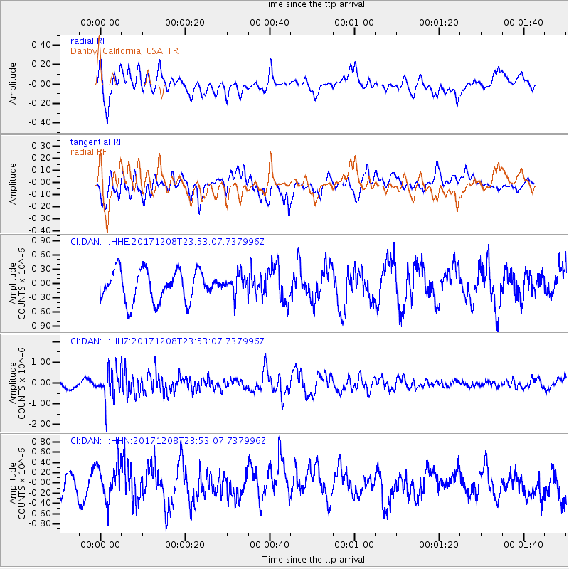
DAN Danby, California, USA - Earthquake Result Viewer
*The percent match for this event was below the threshold and hence no stack was calculated.
| Earthquake location: |
Tonga Islands |
| Earthquake latitude/longitude: |
-16.1/-174.0 |
| Earthquake time(UTC): |
2017/12/08 (342) 23:42:09 GMT |
| Earthquake Depth: |
117 km |
| Earthquake Magnitude: |
5.7 mb |
| Earthquake Catalog/Contributor: |
NEIC PDE/us |
|
| Network: |
CI Caltech Regional Seismic Network |
| Station: |
DAN Danby, California, USA |
| Lat/Lon: |
34.64 N/115.38 W |
| Elevation: |
398 m |
|
| Distance: |
75.1 deg |
| Az: |
46.726 deg |
| Baz: |
238.07 deg |
| Ray Param: |
$rayparam |
*The percent match for this event was below the threshold and hence was not used in the summary stack. |
|
| Radial Match: |
59.365383 % |
| Radial Bump: |
400 |
| Transverse Match: |
69.95621 % |
| Transverse Bump: |
400 |
| SOD ConfigId: |
13570011 |
| Insert Time: |
2019-04-29 09:42:26.611 +0000 |
| GWidth: |
2.5 |
| Max Bumps: |
400 |
| Tol: |
0.001 |
|
Signal To Noise
| Channel | StoN | STA | LTA |
| CI:DAN: :HHZ:20171208T23:53:07.737996Z | 2.4453156 | 6.795054E-7 | 2.7788045E-7 |
| CI:DAN: :HHN:20171208T23:53:07.737996Z | 1.6783359 | 3.455021E-7 | 2.058599E-7 |
| CI:DAN: :HHE:20171208T23:53:07.737996Z | 0.65971106 | 2.155535E-7 | 3.2673924E-7 |
| Arrivals |
| Ps | |
| PpPs | |
| PsPs/PpSs | |


