P20A De Beque, CO, USA - Earthquake Result Viewer
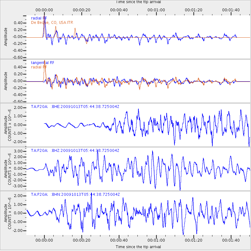
Earthquake location: Fox Islands, Aleutian Islands
Earthquake latitude/longitude: 52.8/-167.0
Earthquake time(UTC): 2009/10/13 (286) 05:37:23 GMT
Earthquake Depth: 24 km
Earthquake Magnitude: 6.0 MB, 6.1 MS, 6.5 MW, 6.5 MW
Earthquake Catalog/Contributor: WHDF/NEIC
Network: TA USArray Transportable Network (new EarthScope stations)
Station: P20A De Beque, CO, USA
Lat/Lon: 39.50 N/108.39 W
Elevation: 1738 m
Distance: 41.6 deg
Az: 84.378 deg
Baz: 308.575 deg
Ray Param: 0.073664546
Estimated Moho Depth: 40.0 km
Estimated Crust Vp/Vs: 1.90
Assumed Crust Vp: 6.291 km/s
Estimated Crust Vs: 3.315 km/s
Estimated Crust Poisson's Ratio: 0.31
Radial Match: 84.84729 %
Radial Bump: 400
Transverse Match: 76.99281 %
Transverse Bump: 400
SOD ConfigId: 2622
Insert Time: 2010-03-06 07:19:13.249 +0000
GWidth: 2.5
Max Bumps: 400
Tol: 0.001

Signal To Noise

ChannelStoNSTALTA
TA:P20A: :BHZ:20091013T05:44:38.725004Z2.56323815.2748214E-72.0578742E-7
TA:P20A: :BHN:20091013T05:44:38.725004Z0.870159862.2138417E-72.544178E-7
TA:P20A: :BHE:20091013T05:44:38.725004Z1.38093782.1588377E-71.5633127E-7
Arrivals
Ps6.1 SECOND
PpPs17 SECOND
PsPs/PpSs23 SECOND