P20A De Beque, CO, USA - Earthquake Result Viewer
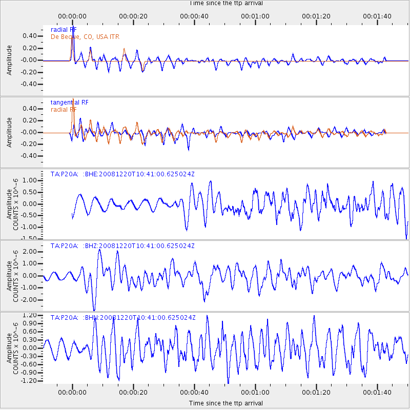
Earthquake location: Off East Coast Of Honshu, Japan
Earthquake latitude/longitude: 36.5/142.4
Earthquake time(UTC): 2008/12/20 (355) 10:29:23 GMT
Earthquake Depth: 19 km
Earthquake Magnitude: 6.0 MB, 6.3 MS, 6.3 MW, 6.3 MW
Earthquake Catalog/Contributor: WHDF/NEIC
Network: TA USArray Transportable Network (new EarthScope stations)
Station: P20A De Beque, CO, USA
Lat/Lon: 39.50 N/108.39 W
Elevation: 1738 m
Distance: 80.2 deg
Az: 47.872 deg
Baz: 309.47 deg
Ray Param: 0.04844692
Estimated Moho Depth: 36.75 km
Estimated Crust Vp/Vs: 2.00
Assumed Crust Vp: 6.291 km/s
Estimated Crust Vs: 3.141 km/s
Estimated Crust Poisson's Ratio: 0.33
Radial Match: 82.28335 %
Radial Bump: 397
Transverse Match: 74.03994 %
Transverse Bump: 400
SOD ConfigId: 2658
Insert Time: 2010-03-06 07:19:25.047 +0000
GWidth: 2.5
Max Bumps: 400
Tol: 0.001

Signal To Noise

ChannelStoNSTALTA
TA:P20A: :BHZ:20081220T10:41:00.625024Z1.89372725.459659E-72.8830232E-7
TA:P20A: :BHN:20081220T10:41:00.625024Z0.77706731.4683809E-71.8896444E-7
TA:P20A: :BHE:20081220T10:41:00.625024Z0.44934619.998943E-82.2252209E-7
Arrivals
Ps6.0 SECOND
PpPs17 SECOND
PsPs/PpSs23 SECOND