You are here: Home > Network List > TA - USArray Transportable Network (new EarthScope stations) Stations List
> Station E20K Nigu River, AK, USA > Earthquake Result Viewer
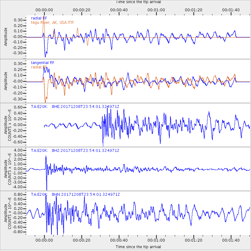
E20K Nigu River, AK, USA - Earthquake Result Viewer
*The percent match for this event was below the threshold and hence no stack was calculated.
| Earthquake location: |
Tonga Islands |
| Earthquake latitude/longitude: |
-16.1/-174.0 |
| Earthquake time(UTC): |
2017/12/08 (342) 23:42:09 GMT |
| Earthquake Depth: |
117 km |
| Earthquake Magnitude: |
5.7 mb |
| Earthquake Catalog/Contributor: |
NEIC PDE/us |
|
| Network: |
TA USArray Transportable Network (new EarthScope stations) |
| Station: |
E20K Nigu River, AK, USA |
| Lat/Lon: |
68.26 N/156.19 W |
| Elevation: |
866 m |
|
| Distance: |
85.1 deg |
| Az: |
6.553 deg |
| Baz: |
197.121 deg |
| Ray Param: |
$rayparam |
*The percent match for this event was below the threshold and hence was not used in the summary stack. |
|
| Radial Match: |
53.83833 % |
| Radial Bump: |
400 |
| Transverse Match: |
56.742477 % |
| Transverse Bump: |
400 |
| SOD ConfigId: |
13570011 |
| Insert Time: |
2019-04-29 09:45:38.537 +0000 |
| GWidth: |
2.5 |
| Max Bumps: |
400 |
| Tol: |
0.001 |
|
Signal To Noise
| Channel | StoN | STA | LTA |
| TA:E20K: :BHZ:20171208T23:54:01.324971Z | 6.1879125 | 1.1814673E-6 | 1.9093147E-7 |
| TA:E20K: :BHN:20171208T23:54:01.324971Z | 2.576985 | 3.7220207E-7 | 1.4443316E-7 |
| TA:E20K: :BHE:20171208T23:54:01.324971Z | 5.414567 | 2.6363864E-7 | 4.8690623E-8 |
| Arrivals |
| Ps | |
| PpPs | |
| PsPs/PpSs | |


