You are here: Home > Network List > TA - USArray Transportable Network (new EarthScope stations) Stations List
> Station F26K Sheenjek River, AK, USA > Earthquake Result Viewer
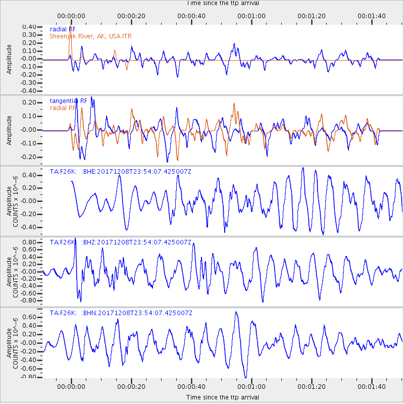
F26K Sheenjek River, AK, USA - Earthquake Result Viewer
*The percent match for this event was below the threshold and hence no stack was calculated.
| Earthquake location: |
Tonga Islands |
| Earthquake latitude/longitude: |
-16.1/-174.0 |
| Earthquake time(UTC): |
2017/12/08 (342) 23:42:09 GMT |
| Earthquake Depth: |
117 km |
| Earthquake Magnitude: |
5.7 mb |
| Earthquake Catalog/Contributor: |
NEIC PDE/us |
|
| Network: |
TA USArray Transportable Network (new EarthScope stations) |
| Station: |
F26K Sheenjek River, AK, USA |
| Lat/Lon: |
67.69 N/144.15 W |
| Elevation: |
683 m |
|
| Distance: |
86.4 deg |
| Az: |
10.962 deg |
| Baz: |
208.608 deg |
| Ray Param: |
$rayparam |
*The percent match for this event was below the threshold and hence was not used in the summary stack. |
|
| Radial Match: |
47.375687 % |
| Radial Bump: |
395 |
| Transverse Match: |
60.56697 % |
| Transverse Bump: |
400 |
| SOD ConfigId: |
13570011 |
| Insert Time: |
2019-04-29 09:45:50.009 +0000 |
| GWidth: |
2.5 |
| Max Bumps: |
400 |
| Tol: |
0.001 |
|
Signal To Noise
| Channel | StoN | STA | LTA |
| TA:F26K: :BHZ:20171208T23:54:07.425007Z | 3.2420948 | 4.3303544E-7 | 1.3356656E-7 |
| TA:F26K: :BHN:20171208T23:54:07.425007Z | 2.0948262 | 2.7809423E-7 | 1.3275289E-7 |
| TA:F26K: :BHE:20171208T23:54:07.425007Z | 0.8988913 | 1.5953843E-7 | 1.7748356E-7 |
| Arrivals |
| Ps | |
| PpPs | |
| PsPs/PpSs | |


