You are here: Home > Network List > TA - USArray Transportable Network (new EarthScope stations) Stations List
> Station H16K Elim, AK, USA > Earthquake Result Viewer
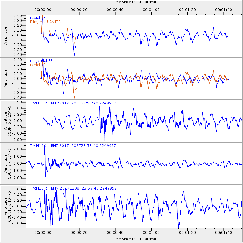
H16K Elim, AK, USA - Earthquake Result Viewer
*The percent match for this event was below the threshold and hence no stack was calculated.
| Earthquake location: |
Tonga Islands |
| Earthquake latitude/longitude: |
-16.1/-174.0 |
| Earthquake time(UTC): |
2017/12/08 (342) 23:42:09 GMT |
| Earthquake Depth: |
117 km |
| Earthquake Magnitude: |
5.7 mb |
| Earthquake Catalog/Contributor: |
NEIC PDE/us |
|
| Network: |
TA USArray Transportable Network (new EarthScope stations) |
| Station: |
H16K Elim, AK, USA |
| Lat/Lon: |
64.64 N/162.24 W |
| Elevation: |
216 m |
|
| Distance: |
81.0 deg |
| Az: |
5.081 deg |
| Baz: |
191.4 deg |
| Ray Param: |
$rayparam |
*The percent match for this event was below the threshold and hence was not used in the summary stack. |
|
| Radial Match: |
71.40917 % |
| Radial Bump: |
400 |
| Transverse Match: |
56.922802 % |
| Transverse Bump: |
400 |
| SOD ConfigId: |
13570011 |
| Insert Time: |
2019-04-29 09:46:00.077 +0000 |
| GWidth: |
2.5 |
| Max Bumps: |
400 |
| Tol: |
0.001 |
|
Signal To Noise
| Channel | StoN | STA | LTA |
| TA:H16K: :BHZ:20171208T23:53:40.224995Z | 4.0626454 | 8.010835E-7 | 1.9718271E-7 |
| TA:H16K: :BHN:20171208T23:53:40.224995Z | 1.6437246 | 3.088464E-7 | 1.8789426E-7 |
| TA:H16K: :BHE:20171208T23:53:40.224995Z | 1.6216465 | 3.2845054E-7 | 2.025414E-7 |
| Arrivals |
| Ps | |
| PpPs | |
| PsPs/PpSs | |


