You are here: Home > Network List > TA - USArray Transportable Network (new EarthScope stations) Stations List
> Station J26L Joseph Creek, AK, USA > Earthquake Result Viewer
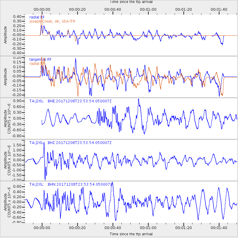
J26L Joseph Creek, AK, USA - Earthquake Result Viewer
*The percent match for this event was below the threshold and hence no stack was calculated.
| Earthquake location: |
Tonga Islands |
| Earthquake latitude/longitude: |
-16.1/-174.0 |
| Earthquake time(UTC): |
2017/12/08 (342) 23:42:09 GMT |
| Earthquake Depth: |
117 km |
| Earthquake Magnitude: |
5.7 mb |
| Earthquake Catalog/Contributor: |
NEIC PDE/us |
|
| Network: |
TA USArray Transportable Network (new EarthScope stations) |
| Station: |
J26L Joseph Creek, AK, USA |
| Lat/Lon: |
64.50 N/143.56 W |
| Elevation: |
1144 m |
|
| Distance: |
83.7 deg |
| Az: |
12.729 deg |
| Baz: |
209.292 deg |
| Ray Param: |
$rayparam |
*The percent match for this event was below the threshold and hence was not used in the summary stack. |
|
| Radial Match: |
67.05077 % |
| Radial Bump: |
400 |
| Transverse Match: |
67.48469 % |
| Transverse Bump: |
400 |
| SOD ConfigId: |
13570011 |
| Insert Time: |
2019-04-29 09:46:14.514 +0000 |
| GWidth: |
2.5 |
| Max Bumps: |
400 |
| Tol: |
0.001 |
|
Signal To Noise
| Channel | StoN | STA | LTA |
| TA:J26L: :BHZ:20171208T23:53:54.050007Z | 4.0560455 | 8.1634994E-7 | 2.0126745E-7 |
| TA:J26L: :BHN:20171208T23:53:54.050007Z | 1.2358736 | 2.0874377E-7 | 1.6890382E-7 |
| TA:J26L: :BHE:20171208T23:53:54.050007Z | 1.2275138 | 2.46798E-7 | 2.0105519E-7 |
| Arrivals |
| Ps | |
| PpPs | |
| PsPs/PpSs | |


