You are here: Home > Network List > TA - USArray Transportable Network (new EarthScope stations) Stations List
> Station Q24A Divide, CO, USA > Earthquake Result Viewer
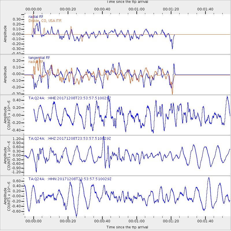
Q24A Divide, CO, USA - Earthquake Result Viewer
*The percent match for this event was below the threshold and hence no stack was calculated.
| Earthquake location: |
Tonga Islands |
| Earthquake latitude/longitude: |
-16.1/-174.0 |
| Earthquake time(UTC): |
2017/12/08 (342) 23:42:09 GMT |
| Earthquake Depth: |
117 km |
| Earthquake Magnitude: |
5.7 mb |
| Earthquake Catalog/Contributor: |
NEIC PDE/us |
|
| Network: |
TA USArray Transportable Network (new EarthScope stations) |
| Station: |
Q24A Divide, CO, USA |
| Lat/Lon: |
38.96 N/105.15 W |
| Elevation: |
2775 m |
|
| Distance: |
84.4 deg |
| Az: |
46.92 deg |
| Baz: |
244.222 deg |
| Ray Param: |
$rayparam |
*The percent match for this event was below the threshold and hence was not used in the summary stack. |
|
| Radial Match: |
70.800964 % |
| Radial Bump: |
400 |
| Transverse Match: |
41.69525 % |
| Transverse Bump: |
400 |
| SOD ConfigId: |
13570011 |
| Insert Time: |
2019-04-29 09:46:43.960 +0000 |
| GWidth: |
2.5 |
| Max Bumps: |
400 |
| Tol: |
0.001 |
|
Signal To Noise
| Channel | StoN | STA | LTA |
| TA:Q24A: :HHZ:20171208T23:53:57.510029Z | 2.6215026 | 4.6072861E-7 | 1.757498E-7 |
| TA:Q24A: :HHN:20171208T23:53:57.510029Z | 1.2516246 | 2.3040288E-7 | 1.8408306E-7 |
| TA:Q24A: :HHE:20171208T23:53:57.510029Z | 1.6137332 | 2.6467706E-7 | 1.6401539E-7 |
| Arrivals |
| Ps | |
| PpPs | |
| PsPs/PpSs | |


