You are here: Home > Network List > TA - USArray Transportable Network (new EarthScope stations) Stations List
> Station P20A De Beque, CO, USA > Earthquake Result Viewer
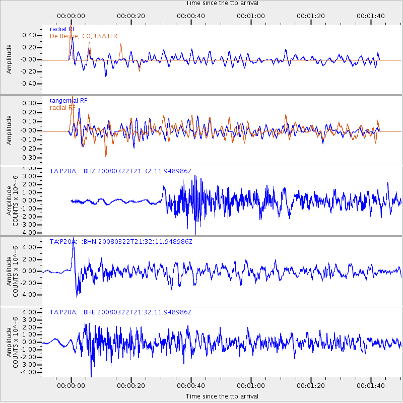
P20A De Beque, CO, USA - Earthquake Result Viewer
*The percent match for this event was below the threshold and hence no stack was calculated.
| Earthquake location: |
Andreanof Islands, Aleutian Is. |
| Earthquake latitude/longitude: |
52.2/-178.7 |
| Earthquake time(UTC): |
2008/03/22 (082) 21:24:11 GMT |
| Earthquake Depth: |
132 km |
| Earthquake Magnitude: |
5.8 MB, 6.2 MW, 6.1 MW |
| Earthquake Catalog/Contributor: |
WHDF/NEIC |
|
| Network: |
TA USArray Transportable Network (new EarthScope stations) |
| Station: |
P20A De Beque, CO, USA |
| Lat/Lon: |
39.50 N/108.39 W |
| Elevation: |
1738 m |
|
| Distance: |
48.7 deg |
| Az: |
75.761 deg |
| Baz: |
309.515 deg |
| Ray Param: |
$rayparam |
*The percent match for this event was below the threshold and hence was not used in the summary stack. |
|
| Radial Match: |
65.83504 % |
| Radial Bump: |
400 |
| Transverse Match: |
68.92664 % |
| Transverse Bump: |
400 |
| SOD ConfigId: |
2504 |
| Insert Time: |
2010-03-06 07:20:28.444 +0000 |
| GWidth: |
2.5 |
| Max Bumps: |
400 |
| Tol: |
0.001 |
|
Signal To Noise
| Channel | StoN | STA | LTA |
| TA:P20A: :BHN:20080322T21:32:11.948986Z | 11.225738 | 2.275074E-6 | 2.0266587E-7 |
| TA:P20A: :BHE:20080322T21:32:11.948986Z | 3.9254613 | 9.280357E-7 | 2.3641445E-7 |
| TA:P20A: :BHZ:20080322T21:32:11.948986Z | 5.064285 | 8.4906077E-7 | 1.676566E-7 |
| Arrivals |
| Ps | |
| PpPs | |
| PsPs/PpSs | |


